December 18, 2017 © Thomas J. Kollenborn. All Rights Reserved.
Read this article here.
Monday, December 25, 2017
Monday, December 18, 2017
Monday, December 11, 2017
The Ruth Conspiracy
December 4, 2017 © Thomas J. Kollenborn. All Rights Reserved.
Many writers have been compelled to address the so-called unsolved mystery of a man’s death in the Superstition Mountains of central Arizona in the summer of 1931. These writers have placed the discovery of Adolph Ruth’s remains in several locations in the region from Needle Canyon to Peter’s Mesa.
The Ruth story is one of the most compelling stories of 20th Century about the missing in the Superstition Mountains. Just who was Adolph Ruth? He was an Easterner from Washington D.C. who had a treasure map and believed he could find the Dutchman’s Lost Mine or the Peralta mines in the rugged interior of the Superstition Wilderness Area known then as the Superstition Primitive Area or basically Tonto National Forest. He arrived in Mesa, Arizona in early May of 1931. A previous friendship with an Arizona family named Morse provided him some names of individuals who could help him find his way into the mountains. He drove out to the Barkley Ranch at the Three R’s, the area known today as Gold Canyon. He talked to William A. “Gus” Barkley about a trip into the Superstition Mountains. Gus advised him to wait until at least November before going into the mountains to camp. Ruth insisted he had to make his trip immediately into the area. Barkley refused to take him for two main reasons. One, he had business in Phoenix and secondly he didn’t think Ruth was capable of making such a trip. After his first meeting with Barkley, Ruth returned to the Morse home in East Mesa asking who could pack him into the mountains. Morse recommended Purnell and Kennan, two local prospector-cowboys who lived in the area off and on.
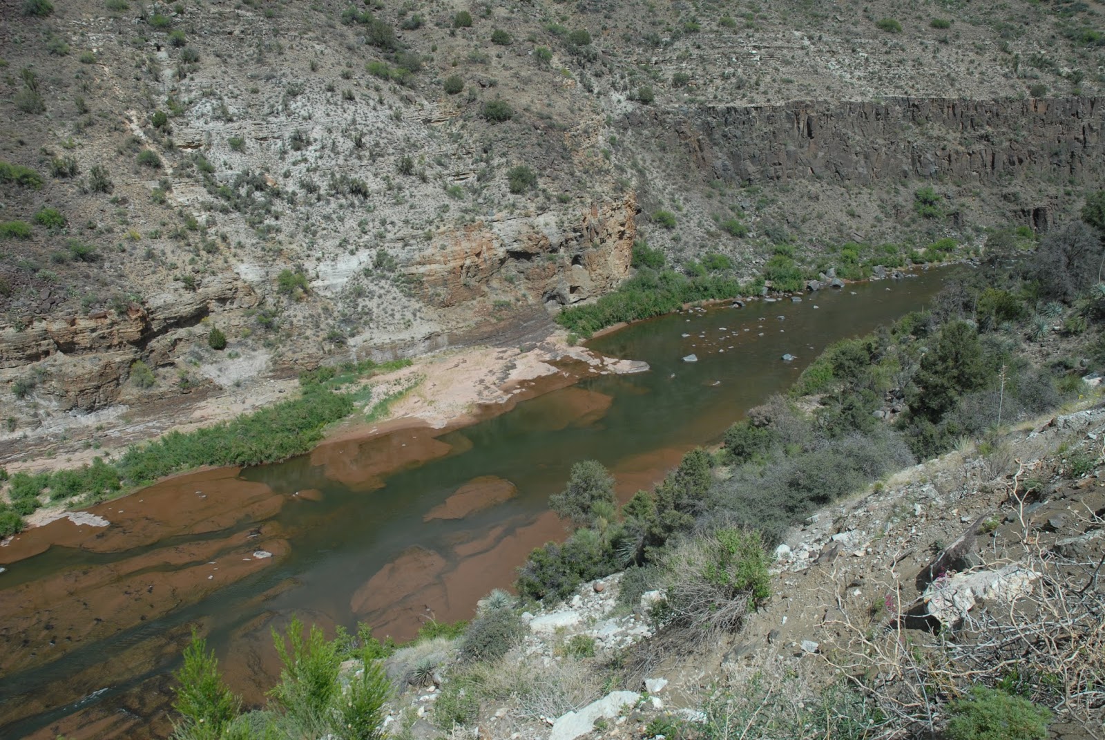
On May 14, 1931, Purnell and Kennan packed Ruth into West Boulder Canyon from the Barkley Camp (First Water Ranch). The trip was very difficult for Ruth and wore out him entirely. It was a long trip over very rough trails from the First Water Ranch to Willow Springs in West Boulder Canyon. The up and down travel was particularly hard on Ruth because of the metal plate in his hip. He suffered immensely making the trip to Willow Springs. Shortly after arriving at Willow Springs Purnell and Kennan quickly unloaded his supplies, helped him set up camp and immediately left Ruth to his fate. Ruth did pen a letter to his wife Clara and sent it out with Purnell and Kennan. Even while suffering from all the pain Ruth was still enthusiastic about his search for the mine. Why he chose West Boulder Canyon for a base camp is still confusing to historians today. What compelling reason did Ruth have to camp at Willow Springs in West Boulder Canyon if he believed Weaver’s Needle was the South Sima on the Peralta Profile Map. A closer look at the material Ruth had may answer some of those questions.
According to several sources Ruth had an old Mexican or Spanish map.
This map was known as the Profile Map. He allegedly obtained it from his son Erwin, who in turn had obtained it from a Mexican officer that he had saved during the revolution in Mexico. Ruth also possessed a U.S.G.S. Topographic Map of the region. Ruth also had a compass, a thermos, and a .44 caliber SW Russian Revolver. William A. Barkley and Deputy Jeff Addams found all these items with Ruth’s remains in January of 1932. Ruth’s skull had been found earlier on December 10, 1931 near Needle Canyon by the Phoenix Archaeological Commission’s Expedition led by Odds Halseth and Harvey Mott. Their guides were Richie Lewis and George “Brownie” Holmes.
Prior to Ruth’s ride into Willow Canyon he spent a couple of nights at the Quarter Circle U Ranch in Pinal County. It was here he met Kennan and Purnell. According to a couple of sources after Ruth left the Quarter Circle U Ranch a group of men were allegedly overheard talking about killing Ruth for his treasure map. This story is extremely far fetched. However, it still circulates in some circles. After the recovery of Ruth’s skeletal remains in late January 1932, it was determined Ruth died of exposure and exhaustion as a result of his trip into the mountains. It was believed by the medical doctors who examined his remains that he died in this manner, not from a bullet to the skull as claimed by many. A forensic pathologist later examined the skull and agreed with the two medical doctors. They said the holes in the skull were caused by animals not a bullet therefore it was concluded he died from natural causes. Two modern forensic pathologist today, Dr. Thomas B. Jarvis and Dr. Jerry Lutes both agreed with the early ruling in Phoenix in 1932. However, with this evidence people still wanted to believe Ruth died from some sinister plot arranged by people who allegedly knew the mine he was looking for was authentic. It was Erwin Ruth who believed his father was murder for his map, however the Arizona Republic published this map shortly after Ruth’s death in their paper.
There are always those who believe in conspiracies and nothing can be done to change their opinions. Adolph Ruth was a crippled and fragile old man who undertook a search he was not capable of doing. He died following a dream in one of the most rugged mountain ranges in the United States in late spring when temperatures could soar up into the 100’s. This was a sad tragedy of an old man trying to follow a dream.
Many writers have been compelled to address the so-called unsolved mystery of a man’s death in the Superstition Mountains of central Arizona in the summer of 1931. These writers have placed the discovery of Adolph Ruth’s remains in several locations in the region from Needle Canyon to Peter’s Mesa.
 |
| Ruth’s skull was found by the City of Phoenix Archaeological Expedition on December 10, 1931. This photo shows George “Brownie” Holmes, Music, and the Ruth’s skull. This photo was taken by Newcomer |
The Ruth story is one of the most compelling stories of 20th Century about the missing in the Superstition Mountains. Just who was Adolph Ruth? He was an Easterner from Washington D.C. who had a treasure map and believed he could find the Dutchman’s Lost Mine or the Peralta mines in the rugged interior of the Superstition Wilderness Area known then as the Superstition Primitive Area or basically Tonto National Forest. He arrived in Mesa, Arizona in early May of 1931. A previous friendship with an Arizona family named Morse provided him some names of individuals who could help him find his way into the mountains. He drove out to the Barkley Ranch at the Three R’s, the area known today as Gold Canyon. He talked to William A. “Gus” Barkley about a trip into the Superstition Mountains. Gus advised him to wait until at least November before going into the mountains to camp. Ruth insisted he had to make his trip immediately into the area. Barkley refused to take him for two main reasons. One, he had business in Phoenix and secondly he didn’t think Ruth was capable of making such a trip. After his first meeting with Barkley, Ruth returned to the Morse home in East Mesa asking who could pack him into the mountains. Morse recommended Purnell and Kennan, two local prospector-cowboys who lived in the area off and on.
On May 14, 1931, Purnell and Kennan packed Ruth into West Boulder Canyon from the Barkley Camp (First Water Ranch). The trip was very difficult for Ruth and wore out him entirely. It was a long trip over very rough trails from the First Water Ranch to Willow Springs in West Boulder Canyon. The up and down travel was particularly hard on Ruth because of the metal plate in his hip. He suffered immensely making the trip to Willow Springs. Shortly after arriving at Willow Springs Purnell and Kennan quickly unloaded his supplies, helped him set up camp and immediately left Ruth to his fate. Ruth did pen a letter to his wife Clara and sent it out with Purnell and Kennan. Even while suffering from all the pain Ruth was still enthusiastic about his search for the mine. Why he chose West Boulder Canyon for a base camp is still confusing to historians today. What compelling reason did Ruth have to camp at Willow Springs in West Boulder Canyon if he believed Weaver’s Needle was the South Sima on the Peralta Profile Map. A closer look at the material Ruth had may answer some of those questions.
According to several sources Ruth had an old Mexican or Spanish map.
This map was known as the Profile Map. He allegedly obtained it from his son Erwin, who in turn had obtained it from a Mexican officer that he had saved during the revolution in Mexico. Ruth also possessed a U.S.G.S. Topographic Map of the region. Ruth also had a compass, a thermos, and a .44 caliber SW Russian Revolver. William A. Barkley and Deputy Jeff Addams found all these items with Ruth’s remains in January of 1932. Ruth’s skull had been found earlier on December 10, 1931 near Needle Canyon by the Phoenix Archaeological Commission’s Expedition led by Odds Halseth and Harvey Mott. Their guides were Richie Lewis and George “Brownie” Holmes.
Prior to Ruth’s ride into Willow Canyon he spent a couple of nights at the Quarter Circle U Ranch in Pinal County. It was here he met Kennan and Purnell. According to a couple of sources after Ruth left the Quarter Circle U Ranch a group of men were allegedly overheard talking about killing Ruth for his treasure map. This story is extremely far fetched. However, it still circulates in some circles. After the recovery of Ruth’s skeletal remains in late January 1932, it was determined Ruth died of exposure and exhaustion as a result of his trip into the mountains. It was believed by the medical doctors who examined his remains that he died in this manner, not from a bullet to the skull as claimed by many. A forensic pathologist later examined the skull and agreed with the two medical doctors. They said the holes in the skull were caused by animals not a bullet therefore it was concluded he died from natural causes. Two modern forensic pathologist today, Dr. Thomas B. Jarvis and Dr. Jerry Lutes both agreed with the early ruling in Phoenix in 1932. However, with this evidence people still wanted to believe Ruth died from some sinister plot arranged by people who allegedly knew the mine he was looking for was authentic. It was Erwin Ruth who believed his father was murder for his map, however the Arizona Republic published this map shortly after Ruth’s death in their paper.
There are always those who believe in conspiracies and nothing can be done to change their opinions. Adolph Ruth was a crippled and fragile old man who undertook a search he was not capable of doing. He died following a dream in one of the most rugged mountain ranges in the United States in late spring when temperatures could soar up into the 100’s. This was a sad tragedy of an old man trying to follow a dream.
Monday, December 4, 2017
Lust for Gold: A Motion Picture
November 27, 2017 © Thomas J. Kollenborn. All Rights Reserved.
The motion picture, “Lust for Gold,” has been the reason for many individuals to begin their search for the Dutchman’s Lost Mine. The release of this film by Columbia Pictures in 1949 started another generation of lost mine searchers in the Superstition Mountains.
Early in 1947 Columbia Picture Corporation bought the rights for Barry Storm’s book, Thunder God’s Gold, with the intention of writing a screenplay and making the book into a motion picture. From the metamorphosis of a book to a motion picture, considerable changes occurred. Ted Sherdeman and Richard English wrote the screenplay, and the film was produced and directed by S. Sylvan Simon. The film was billed as the “true story of a secret treasure.” This film was meant to be Columbia’s competition against Republic’s film, “Treasure of the Sierra Madres,” starring Humphrey Bogart. “Lust of Gold” starred Glenn Ford, Ida Lupino, Gig Young, William Prince and Edgar Buchanan.
Glenn Ford played the role of Jacob Waltz, the Dutchman. Ida Lupino played the role of Julia Thomas. William Prince played the role of Julia Thomas’ husband. Gig Young played the role of Barry Storm, a modern adventurer and prospector. Edgar Buchanan played the role of Waltz’s partner. Three other prominent stars also had roles in this film. These stars included Will Greer, Jay Silverheels and Paul Ford.
The producers of this film asked Arizona’s Governor Dan E. Garvey for a letter of authenticity about the Lost Dutchman Mine. The governor wrote a letter that basically stated the story presented by Columbia Picture Corporation was a true account describing the Lost Dutchman Mine.
Portions of the motion picture were filmed on the studio lot; however a large percentage of the film was filmed on location along the Apache Trail. Many scenes were filmed in the area near the Salt River Project access road to Horse Mesa Dam. The film opens with a spectacular scene of Superstition Mountain with an adventurer named Paul Buckley hiking toward the Superstition Mountain. A narration describes how rugged the mountains are, how dangerous they are and that many people had lost their lives in these mountains searching for gold. The film’s narrator talked about a cache of gold worth twenty million dollars hidden in these mountains. According to the story, the Apaches, under the leadership of Cochise, killed the Peraltas and buried their gold.
The film then introduces a treasure hunter by the name of Floyd Buckley, who appears to know what he is talking about. Barry Storm is portrayed as the grandson of Jacob Waltz, the German prospector who had a rich gold mine in the Superstition Wilderness Area. Storm tries to talk Buckley into accepting him as a partner, but Buckley quickly brushes him off.
Buckley hikes off into the Superstition Mountains and is mysteriously murdered in an ambush. Storm had followed Buckley to the point where he was killed, but didn’t witness the shooting. He did hear the shot and found Buckley’s body. According to the film, Storm ran and walked thirty-six miles to Apache Junction to report the murder. Ironically, there is no place in the Superstition Wilderness, particularly the western portion that would be thirty-six miles from Apache Junction.
At this point in the film, Barry Storm begins his research about the infamous tale of the Lost Dutchman Mine. He travels to the pioneer’s home and finds out about Jacob Waltz. Here, the producer of the film inserts many of the stories about Waltz being a murderer. Storm found out at the Pioneer’s Home that the Lost Dutchman Mine and the Peralta Mine were all one and the same.
The film stresses the cactus marker with the stones in it as one of the key markers in locating the mine. This clue continues to surface today in a variety of stories about the Lost Dutchman Mine. The film also presents an interesting correlation between the sunburst, ORO and snake on Black Top Mesa and the one in the film. According to the film, Manuel, Pedro and Ramon cached the gold somewhere in the Superstition Mountain where the moon shines through a window rock revealing its location.
Glenn Ford was far too young to portray Jacob Waltz, who was 64 years old at the time. Waltz arrived in the territory from California in 1863 with the Peeples-Weaver Party. Waltz spent his first five years in the Prescott area before moving to the Salt River Valley in 1868. Most documents about Waltz indicate he was the opposite type of person the film portrays. Many sources reported Waltz as well liked and a kindly person. Records indicate he voted in every election after receiving his citizenship in 1861 in California. The film reveals Waltz as a vicious, premeditated murderer. This was absolutely not true. Ever since I have been doing research on this subject, some researchers have been constantly trying to prove Waltz was a murderer.
Much of this film is based on exactly what Barry Storm believed, but the problem with that is, Barry Storm’s research was not that accurate. Barry, like a lot of researchers, developed “facts” that fit their own scenarios. Often this is true of researchers trying to answer their own questions. The story of Waltz hearing the pounding of steel against rock just before discovery of the Mexican mine is part of the Storm scenario.
The film portrays Waltz as an illiterate immigrant who could not write or even sign his name. Historical documents prove this totally incorrect. Waltz signed many documents between 1848-1889. It is a fact that no known letters written by Jacob Waltz have survived. Many of Waltz’s signed documents have survived to this day.
Ida Lupino played the role of Julia Thomas. The film portrayed her as Emil Thomas’ wife and Waltz’s lover. This was as far from the truth as any part of the film. Supposedly, Julia Thomas was trying to talk Waltz into taking her to his mine. Julia Thomas and her husband certainly didn’t die in a big earthquake at Waltz’s mine in the Superstition Mountains. Julia Thomas was born Julia Kahn (Korn) in Louisiana in 1867. She was married to Emil Thomas in Centrailia, Mitchell Co., Texas, in 1883. Julia Thomas moved to Phoenix in 1885 and divorced Emil Thomas in 1895. She then married Albert Shaeffer in 1896. She died of Bright’s disease in December of 1917, in Phoenix, Arizona.
Jacob Waltz was in Julia Thomas’ home at the time of his death. He was about 81 years old. Julia became his caregiver when he could no longer care for himself.
The entire script for the film was made up from material provided to the scriptwriters by Barry Storm (John T. Climenson). The film was first titled Bonanza, than this title was changed. Finally, the title “Lust for Gold” was accepted. Near the release time of the film, Barry Storm filed a lawsuit against the Columbia Picture Corporation claiming they lied about him saying he was Jacob Waltz grandson. He wanted this part of the film changed or more money. Columbia eventually settled with Storm and released the film in 1949. The film was a nightmare from the beginning for Columbia Pictures to produce because of Barry Storm and his various legal maneuvers.
S. Sylvan Simon did an excellent job directing this film. His props and stunts where basically ahead of their time. The mine scene was totally constructed at the studio. When the earthquake scene started, one could see what an elaborate stage Simon had created. Simon was a man who never overlooked the most infinite detail. However, there were a few things they did miss. The rattlesnake scene was terrible. The rubber rattlesnake did not look real at all. Then when they finally showed the live rattlesnake, it was not a Western Diamondback, but a specimen of rattlesnake not even indigenous to the Superstition Mountain area.
The final scene at the mine when the Apaches attacked was very interesting. The stunts were superb, especially the lance and arrow scenes. However, it was difficult to agree with arrows sticking in stone. The reason for this problem was, the scene moved extremely fast from beginning to end, and there was little time to cut certain portions of the scenes.
Lust for Gold never became a household name. Republic’s film, “Treasure of the Sierra Madres,” became a classic because of the star Humphrey Bogart and the story the film told. Republic’s film was far more believable then Columbia’s film.
Many of the people who talk about the Lost Dutchman Mine learned much of their information from books or the film, “Lust for Gold.” This film has introduced many generations to the history and legends of Superstition Mountain. Occasionally you can still watch “Lust for Gold” on the late night show or on a Saturday matinee.
Barry Storm wrote the book, “Thunder God’s Gold,” while living in a cave in Surprise Canyon near Tortilla Flat in 1949. He found living there suitable for his needs. He bought supplies at Tortilla Flat. This was the book “Lust For Gold” was based on.
The motion picture, “Lust for Gold,” has been the reason for many individuals to begin their search for the Dutchman’s Lost Mine. The release of this film by Columbia Pictures in 1949 started another generation of lost mine searchers in the Superstition Mountains.
 |
| Barry Storm signing his book “Thunder God’s Gold” for Ida Lupino, one of the stars in “Lust for Gold.” |
Early in 1947 Columbia Picture Corporation bought the rights for Barry Storm’s book, Thunder God’s Gold, with the intention of writing a screenplay and making the book into a motion picture. From the metamorphosis of a book to a motion picture, considerable changes occurred. Ted Sherdeman and Richard English wrote the screenplay, and the film was produced and directed by S. Sylvan Simon. The film was billed as the “true story of a secret treasure.” This film was meant to be Columbia’s competition against Republic’s film, “Treasure of the Sierra Madres,” starring Humphrey Bogart. “Lust of Gold” starred Glenn Ford, Ida Lupino, Gig Young, William Prince and Edgar Buchanan.
Glenn Ford played the role of Jacob Waltz, the Dutchman. Ida Lupino played the role of Julia Thomas. William Prince played the role of Julia Thomas’ husband. Gig Young played the role of Barry Storm, a modern adventurer and prospector. Edgar Buchanan played the role of Waltz’s partner. Three other prominent stars also had roles in this film. These stars included Will Greer, Jay Silverheels and Paul Ford.
The producers of this film asked Arizona’s Governor Dan E. Garvey for a letter of authenticity about the Lost Dutchman Mine. The governor wrote a letter that basically stated the story presented by Columbia Picture Corporation was a true account describing the Lost Dutchman Mine.
Portions of the motion picture were filmed on the studio lot; however a large percentage of the film was filmed on location along the Apache Trail. Many scenes were filmed in the area near the Salt River Project access road to Horse Mesa Dam. The film opens with a spectacular scene of Superstition Mountain with an adventurer named Paul Buckley hiking toward the Superstition Mountain. A narration describes how rugged the mountains are, how dangerous they are and that many people had lost their lives in these mountains searching for gold. The film’s narrator talked about a cache of gold worth twenty million dollars hidden in these mountains. According to the story, the Apaches, under the leadership of Cochise, killed the Peraltas and buried their gold.
The film then introduces a treasure hunter by the name of Floyd Buckley, who appears to know what he is talking about. Barry Storm is portrayed as the grandson of Jacob Waltz, the German prospector who had a rich gold mine in the Superstition Wilderness Area. Storm tries to talk Buckley into accepting him as a partner, but Buckley quickly brushes him off.
Buckley hikes off into the Superstition Mountains and is mysteriously murdered in an ambush. Storm had followed Buckley to the point where he was killed, but didn’t witness the shooting. He did hear the shot and found Buckley’s body. According to the film, Storm ran and walked thirty-six miles to Apache Junction to report the murder. Ironically, there is no place in the Superstition Wilderness, particularly the western portion that would be thirty-six miles from Apache Junction.
At this point in the film, Barry Storm begins his research about the infamous tale of the Lost Dutchman Mine. He travels to the pioneer’s home and finds out about Jacob Waltz. Here, the producer of the film inserts many of the stories about Waltz being a murderer. Storm found out at the Pioneer’s Home that the Lost Dutchman Mine and the Peralta Mine were all one and the same.
The film stresses the cactus marker with the stones in it as one of the key markers in locating the mine. This clue continues to surface today in a variety of stories about the Lost Dutchman Mine. The film also presents an interesting correlation between the sunburst, ORO and snake on Black Top Mesa and the one in the film. According to the film, Manuel, Pedro and Ramon cached the gold somewhere in the Superstition Mountain where the moon shines through a window rock revealing its location.
Glenn Ford was far too young to portray Jacob Waltz, who was 64 years old at the time. Waltz arrived in the territory from California in 1863 with the Peeples-Weaver Party. Waltz spent his first five years in the Prescott area before moving to the Salt River Valley in 1868. Most documents about Waltz indicate he was the opposite type of person the film portrays. Many sources reported Waltz as well liked and a kindly person. Records indicate he voted in every election after receiving his citizenship in 1861 in California. The film reveals Waltz as a vicious, premeditated murderer. This was absolutely not true. Ever since I have been doing research on this subject, some researchers have been constantly trying to prove Waltz was a murderer.
Much of this film is based on exactly what Barry Storm believed, but the problem with that is, Barry Storm’s research was not that accurate. Barry, like a lot of researchers, developed “facts” that fit their own scenarios. Often this is true of researchers trying to answer their own questions. The story of Waltz hearing the pounding of steel against rock just before discovery of the Mexican mine is part of the Storm scenario.
The film portrays Waltz as an illiterate immigrant who could not write or even sign his name. Historical documents prove this totally incorrect. Waltz signed many documents between 1848-1889. It is a fact that no known letters written by Jacob Waltz have survived. Many of Waltz’s signed documents have survived to this day.
Ida Lupino played the role of Julia Thomas. The film portrayed her as Emil Thomas’ wife and Waltz’s lover. This was as far from the truth as any part of the film. Supposedly, Julia Thomas was trying to talk Waltz into taking her to his mine. Julia Thomas and her husband certainly didn’t die in a big earthquake at Waltz’s mine in the Superstition Mountains. Julia Thomas was born Julia Kahn (Korn) in Louisiana in 1867. She was married to Emil Thomas in Centrailia, Mitchell Co., Texas, in 1883. Julia Thomas moved to Phoenix in 1885 and divorced Emil Thomas in 1895. She then married Albert Shaeffer in 1896. She died of Bright’s disease in December of 1917, in Phoenix, Arizona.
Jacob Waltz was in Julia Thomas’ home at the time of his death. He was about 81 years old. Julia became his caregiver when he could no longer care for himself.
The entire script for the film was made up from material provided to the scriptwriters by Barry Storm (John T. Climenson). The film was first titled Bonanza, than this title was changed. Finally, the title “Lust for Gold” was accepted. Near the release time of the film, Barry Storm filed a lawsuit against the Columbia Picture Corporation claiming they lied about him saying he was Jacob Waltz grandson. He wanted this part of the film changed or more money. Columbia eventually settled with Storm and released the film in 1949. The film was a nightmare from the beginning for Columbia Pictures to produce because of Barry Storm and his various legal maneuvers.
S. Sylvan Simon did an excellent job directing this film. His props and stunts where basically ahead of their time. The mine scene was totally constructed at the studio. When the earthquake scene started, one could see what an elaborate stage Simon had created. Simon was a man who never overlooked the most infinite detail. However, there were a few things they did miss. The rattlesnake scene was terrible. The rubber rattlesnake did not look real at all. Then when they finally showed the live rattlesnake, it was not a Western Diamondback, but a specimen of rattlesnake not even indigenous to the Superstition Mountain area.
The final scene at the mine when the Apaches attacked was very interesting. The stunts were superb, especially the lance and arrow scenes. However, it was difficult to agree with arrows sticking in stone. The reason for this problem was, the scene moved extremely fast from beginning to end, and there was little time to cut certain portions of the scenes.
Lust for Gold never became a household name. Republic’s film, “Treasure of the Sierra Madres,” became a classic because of the star Humphrey Bogart and the story the film told. Republic’s film was far more believable then Columbia’s film.
Many of the people who talk about the Lost Dutchman Mine learned much of their information from books or the film, “Lust for Gold.” This film has introduced many generations to the history and legends of Superstition Mountain. Occasionally you can still watch “Lust for Gold” on the late night show or on a Saturday matinee.
Barry Storm wrote the book, “Thunder God’s Gold,” while living in a cave in Surprise Canyon near Tortilla Flat in 1949. He found living there suitable for his needs. He bought supplies at Tortilla Flat. This was the book “Lust For Gold” was based on.
Monday, November 27, 2017
Gold Fever and Summer Hell
November 20, 2017 © Thomas J. Kollenborn. All Rights Reserved.
Many of you have read articles I have written about tragedies in Superstition Wilderness Area over the years. Probably the worst tragedy was the three Utah prospectors that died in the summer of 2010. They were attracted to the mountain by stories of gold bullion buried near Yellow Peak. Their ignorance of conditions in these mountains during the summer months led to their deaths.
I can excuse somebody for going into the mountains under these conditions, believing they would return with sacks of bullion gold. Now I would like to tell you another story of incident that could have led to the same tragic end. Ironically, I was involved in this search.
Working on the Quarter U Ranch in the late fifties certainly familiarized me with the summer conditions in this mountain. When we had range work to do in the summer months we were horseback by 4:00 a.m. and would return to the ranch before noon, knowing how bad the heat could get in the afternoon. It is not any fun riding back to the ranch after a morning of hard work in the desert sun during the month of June or July. Cowboys, in general, loved the raining season on the lower desert and always looked forward to it.
Back in the late 1970s I was ask to help on a pack trip into the Superstition Wilderness Area on June 10. This particular year, the temperatures were ranging between 95° and 110°F for twenty-four hours a day. I knew the idea was a bit insane, however I was still young and in love with the history of these mountains and its people. It was summer time and I had plenty of time.
I got three horses from “Arkie” Johnston and packed this Dutch Hunter named Ernest into the mountains. He wanted to stay at least four days. I told him we would have stay where there was water. During the heat of summer this didn’t allow very many options. We could stay at, or near, Hackberry Springs, Second Water, Bluff Springs, or Charlebois. Ernest was interested in a spot on Peter’s Mesa. I couldn’t believe he wanted to go in this time of the year. He explained to me nobody would be out there in this heat and his knowledge would be better protected of golden treasure in a cave. We left First Water at 4:00 a.m. and it was still a little warm. It hadn’t cooled off much that night. We arrived at Charlebois Spring about 8:00 a.m. and set up camp. There was plenty of water for the horses, but sometimes difficult to water them. Ernest got his pack ready and strapped on his revolver. He started up the trail to the top of Peter Mesa. I stayed in camp with the horses. It was a hot, miserable day at Charlebois because of the gnats and bugs. I am sure the temperature got up to 110°F. At sundown there was no sign of Ernest. I soon became worried; after all, he was in his early sixties. Soon my concern was replaced with anguish.
Sometime after dark I heard a call for “help” coming from the trail to the top of Peter’s Mesa. I grabbed a shoulder canteen and a flashlight and started up the trail to Peter’s Mesa. I knew I would find Ernest somewhere along the trail. The climb up the trail caused me to perspire heavily. About a mile up the trail I found Ernest lying beside the trail. It looked like he might have broken his ankle or something. He was in severe pain. A simple pack trip was becoming an emergency for me. I told Ernest I was going back to get a couple of horses and it would be a couple of hours before I would be back. He kept trying to tell me about finding the cave full of gold bars. The truth was I didn’t care. We had an emergency at hand. I scrambled back down the trail to Charlebois Spring and picked up two saddle horses. I rode back up to the site where Ernest was lying. His leg really looked bad just above the ankle. At this point we couldn’t get his boot back on. I loaded him on the horse and put his injured foot in the stirrup. We then started the downhill ride back to Charlebois Spring. I told him I would have to ride out and get ahold of the Sheriff’s Office so we could get a helicopter in to take him out. Ernest said he was going to ride out. No helicopter for him. We made it back to camp. Closer examination of his foot revealed it was not broken, or at least not a compound fracture of any kind.
About 3:30 a.m. I corraled the horses and began to pack up camp. We were on the trail by sunup. Our ride out to First Water was basically uneventful other than Ernest talking about finding the “Cave full of gold bars.” I had several letters from Ernest in my files, but I never heard from him again. Many years later a relative of Ernest contacted me. He wanted to know if Ernest found anything in the mountains worthwhile. He seriously injured his foot. I told them I did not see anything worthwhile that he found, but he sure suffered gold fever and summer hell.
Monday, November 20, 2017
Edwin's War
November 13, 2017 © Thomas J. Kollenborn. All Rights Reserved.
 |
| Edwin flew 33 missions over Germany during World War II as a waist gunner on a B-24 Liberator bomber. Known to many aviators as the “flying coffin.” He flew out of an Army Air Corps base in Italy. The “Redtails” protected many of their flights over Germany. |
Monday, November 13, 2017
Arizona's Apache Trail
November 6, 2017 © Thomas J. Kollenborn. All Rights Reserved.
There is nothing more Arizona than the story of the Apache Trail and the challenges to build it between 1903-1905. This roadway was at the center of one of the first major efforts to promote Arizona and its beautiful climate by the Southern Pacific Railroad between 1915-1927. There are many stories about Arizona, however Arizona history would be incomplete without this story.
The Apache Trail can certainly be classified as one of the most adventurous and scenic routes in the American Southwest. Since 1906 tourists have traveled this unique mountain road and marveled at some of the most spectacular scenery in our state. The Apache Trail originally began in Phoenix and terminated at Roosevelt Dam. The most significant portion of roadway began at the Mesa railhead and terminated at Roosevelt Dam site on the Salt River some sixty-two miles away.
The approximate route of the Apache Trail has served humanity for more than a millennium. The Salado used the trail to penetrate the Salt River Valley around 900 A.D. Other Native American groups continued to use the trail as a migratory route between their winter homes on the desert lowlands and their summer homes in the mountains along the Mogollon Rim.
The Apaches and Yavapais used the trail for their predatory raids against the Pimas along the Salt and Gila Rivers south and west of Superstition Mountain. The Apaches and Yavapais continued their raids after the arrival of the Anglo-Americans in the early 1850s. Finally in 1864, Camp McDowell was established along the Verde River some four miles north of the Salt River. The Pimas became willing allies of the blue-shirted soldiers who manned Fort McDowell. This footpath (trail) along the Salt River through the mountains to Tonto Basin was called both the Tonto Trail and the Yavapai Trail on different occasions. The Army quelled the predatory ways Apaches-Yavapais in this region by 1868. There were other military campaigns fought against renegade Apaches from 1871 until Geronimo’s surrender in 1886 at Skeleton Canyon in Southern Arizona.
A young man navigated the Salt River near the present site of Roosevelt Dam to Phoenix in a cataract boat during the early part of the 1880s. He reported numerous ideal dam sites along the river’s course. The Maricopa County Board of Supervisors ordered a feasibility study done on the Salt River for possible water storage and flood control dam sites shortly thereafter. William “Billy” Breakenridge, James H. McClintock, and John H. Norton conducted a feasibility study for the county board of supervisors. Breakenridge also explored the route for a possible wagon road at the time of this study. Billy Breakenridge was a well-known Tombstone lawman during the 1880s. James McClintock became Arizona’s first official historian.
Breakenridge’s report was highly favored for the construction of a dam just downstream from the confluence of Tonto Creek and the Salt River. The Congress of the United States authorized the construction of a dam and the project was funded in March of 1903. The task of supervising the building of this dam was given to the newly formed U.S. Bureau of Reclamation Service under the United States Department of Interior. This was one of the first major building projects in America shortly after the beginning of the 20th Century.
Immediately after funds were approved by Congress the communities of the Salt River Valley realized no money was appropriated for the construction of a haul road from Phoenix to the dam site. The valley communities wanted to participate in this economic boom. They wanted a greater involvement in the market developed by the construction of Roosevelt Dam. The communities immediately worked on a bonding plan to raise enough money to fund the construction of the Mesa-Roosevelt Road.
Actual construction of the Tonto Wagon Road, as it was known in the beginning, began on August 29, 1903, with two hundred Apache laborers working just below the dam site on the Salt River. Another work camp was established on November 11, 1903, at Government Well, some twenty-five miles from Mesa, employing some 200 Pima laborers. The Tonto Wagon Road was completed on September 3, 1905, at a cost of $551,000. The road was sixty-two miles in distance, running from the Tonto Dam site to the Mesa railhead. It was reported that more than a million and half pounds of freight moved over the road in its first month of operation. By 1912, the year of statehood, Roosevelt Dam was completed and supplied water and hydroelectric power to the Salt River Valley and the mines at Globe.
The first Concord stage made a run over the Mesa-Roosevelt Road on June 10, 1905. The first automobile that traveled over the road from Mesa to Government Wells was on August 23, 1905. This Knox Automobile was known as the “Red Terror.” The first so-called tourist group to travel over the Mesa-Roosevelt Road was on October 10, 1905. The first major accident to occur on the Mesa-Roosevelt Road occurred between Mormon Flat and Fish Creek Hill with a stagecoach. The accident occurred on November 23, 1905. The curves, steep grades, and narrowness of the Mesa-Roosevelt road challenged the skills of early teamster and drivers. Even today, as we drive the Apache Trail, the road still challenges our skills as drivers.
The Mesa-Roosevelt Road was highly regulated during the construction of Roosevelt Dam (1906-1911), however, when the construction was over, the road became a favorite tourist attraction. The road was known as the Mesa-Roosevelt Road and Tonto Wagon Road during the period between 1903-1915. Sometimes the media called the road the Roosevelt Road. Shortly after 1915 the road became known as the Apache Trail. Historians appear to agree in general as to the origin of the name “Apache Trail.” They believe the term was coined by an enterprising young entrepreneur who worked as a railroad agent for the Southern Pacific. The man’s name was E.E. Watson. Watson was trying to promote the Southern Pacific’s “Sunset Limited” as it made its way through Arizona. The Southern Pacific offered a side trip for its transcontinental passengers over the Apache Trail if they were interested. Southern Pacific had the franchise on the Apache Trail as a special side trip for their passengers. The Southern Pacific Railroad promoted the Apache Trail widely in advertisements all over America and even in Western Europe from 1915 through 1929.
The Apache Trail (State Route 88) was officially dedicated as Arizona’s first historic highway on February 25, 1987, at Lost Dutchman State Park along the Apache Trail. Tourists have been traveling the Apache Trail since 1906. They have been enjoying one of the most beautiful desert highways in America. The Apache Trail is a roadway to adventure, beauty and history. President Theodore Roosevelt was given credit for the following words about the Apache Trail.
Recently the State of Arizona has done a lot of construction on the Apache Trail. These repairs were to recent storm damage along the “Trail” from last summer. The surface of the road is so rough between Apache Junction and end of the pavement six miles east of Tortilla Flat the road is going to be resurfaced. You should remember this road is not the responsibility of the state, county, or government. Actually the road is property of the Salt River Project originally, but its care and maintenance has shifted over to the ADOT. Legally who liability is the road in case of lawsuits as the result of accidents? I chaired the Historic Highway Committee in 1986-1987. We never found a responsible party for the Apache Trail. The State of Arizona did want to designate the highway “Arizona’s First Historical Highway.” Today, is debatable as to whether U.S. Route 66 or the Apache Trail was Arizona’s first historic highway.
 |
| Apache Trail on the Fish Creek Hill descent. |
The Apache Trail can certainly be classified as one of the most adventurous and scenic routes in the American Southwest. Since 1906 tourists have traveled this unique mountain road and marveled at some of the most spectacular scenery in our state. The Apache Trail originally began in Phoenix and terminated at Roosevelt Dam. The most significant portion of roadway began at the Mesa railhead and terminated at Roosevelt Dam site on the Salt River some sixty-two miles away.
The approximate route of the Apache Trail has served humanity for more than a millennium. The Salado used the trail to penetrate the Salt River Valley around 900 A.D. Other Native American groups continued to use the trail as a migratory route between their winter homes on the desert lowlands and their summer homes in the mountains along the Mogollon Rim.
The Apaches and Yavapais used the trail for their predatory raids against the Pimas along the Salt and Gila Rivers south and west of Superstition Mountain. The Apaches and Yavapais continued their raids after the arrival of the Anglo-Americans in the early 1850s. Finally in 1864, Camp McDowell was established along the Verde River some four miles north of the Salt River. The Pimas became willing allies of the blue-shirted soldiers who manned Fort McDowell. This footpath (trail) along the Salt River through the mountains to Tonto Basin was called both the Tonto Trail and the Yavapai Trail on different occasions. The Army quelled the predatory ways Apaches-Yavapais in this region by 1868. There were other military campaigns fought against renegade Apaches from 1871 until Geronimo’s surrender in 1886 at Skeleton Canyon in Southern Arizona.
A young man navigated the Salt River near the present site of Roosevelt Dam to Phoenix in a cataract boat during the early part of the 1880s. He reported numerous ideal dam sites along the river’s course. The Maricopa County Board of Supervisors ordered a feasibility study done on the Salt River for possible water storage and flood control dam sites shortly thereafter. William “Billy” Breakenridge, James H. McClintock, and John H. Norton conducted a feasibility study for the county board of supervisors. Breakenridge also explored the route for a possible wagon road at the time of this study. Billy Breakenridge was a well-known Tombstone lawman during the 1880s. James McClintock became Arizona’s first official historian.
Breakenridge’s report was highly favored for the construction of a dam just downstream from the confluence of Tonto Creek and the Salt River. The Congress of the United States authorized the construction of a dam and the project was funded in March of 1903. The task of supervising the building of this dam was given to the newly formed U.S. Bureau of Reclamation Service under the United States Department of Interior. This was one of the first major building projects in America shortly after the beginning of the 20th Century.
Immediately after funds were approved by Congress the communities of the Salt River Valley realized no money was appropriated for the construction of a haul road from Phoenix to the dam site. The valley communities wanted to participate in this economic boom. They wanted a greater involvement in the market developed by the construction of Roosevelt Dam. The communities immediately worked on a bonding plan to raise enough money to fund the construction of the Mesa-Roosevelt Road.
Actual construction of the Tonto Wagon Road, as it was known in the beginning, began on August 29, 1903, with two hundred Apache laborers working just below the dam site on the Salt River. Another work camp was established on November 11, 1903, at Government Well, some twenty-five miles from Mesa, employing some 200 Pima laborers. The Tonto Wagon Road was completed on September 3, 1905, at a cost of $551,000. The road was sixty-two miles in distance, running from the Tonto Dam site to the Mesa railhead. It was reported that more than a million and half pounds of freight moved over the road in its first month of operation. By 1912, the year of statehood, Roosevelt Dam was completed and supplied water and hydroelectric power to the Salt River Valley and the mines at Globe.
The first Concord stage made a run over the Mesa-Roosevelt Road on June 10, 1905. The first automobile that traveled over the road from Mesa to Government Wells was on August 23, 1905. This Knox Automobile was known as the “Red Terror.” The first so-called tourist group to travel over the Mesa-Roosevelt Road was on October 10, 1905. The first major accident to occur on the Mesa-Roosevelt Road occurred between Mormon Flat and Fish Creek Hill with a stagecoach. The accident occurred on November 23, 1905. The curves, steep grades, and narrowness of the Mesa-Roosevelt road challenged the skills of early teamster and drivers. Even today, as we drive the Apache Trail, the road still challenges our skills as drivers.
The Mesa-Roosevelt Road was highly regulated during the construction of Roosevelt Dam (1906-1911), however, when the construction was over, the road became a favorite tourist attraction. The road was known as the Mesa-Roosevelt Road and Tonto Wagon Road during the period between 1903-1915. Sometimes the media called the road the Roosevelt Road. Shortly after 1915 the road became known as the Apache Trail. Historians appear to agree in general as to the origin of the name “Apache Trail.” They believe the term was coined by an enterprising young entrepreneur who worked as a railroad agent for the Southern Pacific. The man’s name was E.E. Watson. Watson was trying to promote the Southern Pacific’s “Sunset Limited” as it made its way through Arizona. The Southern Pacific offered a side trip for its transcontinental passengers over the Apache Trail if they were interested. Southern Pacific had the franchise on the Apache Trail as a special side trip for their passengers. The Southern Pacific Railroad promoted the Apache Trail widely in advertisements all over America and even in Western Europe from 1915 through 1929.
The Apache Trail (State Route 88) was officially dedicated as Arizona’s first historic highway on February 25, 1987, at Lost Dutchman State Park along the Apache Trail. Tourists have been traveling the Apache Trail since 1906. They have been enjoying one of the most beautiful desert highways in America. The Apache Trail is a roadway to adventure, beauty and history. President Theodore Roosevelt was given credit for the following words about the Apache Trail.
“The Apache Trail combines the grandeur of the Alps, the glory of the Rockies, the magnificence of the Grand Canyon and then adds an indefinable something that none of the others have, to me, it is most awe-inspiring and most sublimely beautiful.”
 |
| Reinforcing the riprap along Weekes Wash (Goldfield) to protect the Apache Trail from erosion. |
Monday, November 6, 2017
White Water
October 30, 2017 © Thomas J. Kollenborn. All Rights Reserved.
The passing of time slowly erodes one’s recollections of the past. Therefore much of our oral history is lost. Some of our history is lost among the dusty old newspaper files at the state archives. Several years ago I was perusing stories from the Phoenix Daily Herald and Tempe News from 1885-1895. I came across a very interesting article in one of these newspapers.
This headline does not sound much like the Salt River we know today between Roosevelt Dam and Granite Reef Dam. Prior to the construction of Roosevelt Dam the Lower Box of the Salt River was a raging torrent according to early Arizona pioneers who navigated its course.
The Salt River had always been a challenge to Arizona pioneers. The search for fording sites along the river created small Arizona hamlets such as Marysville. The soldiers at Fort McDowell used the fording site at Marysville to pursue the Yavapais along the upper Salt River and into the Superstition Mountains.
The challenge to run this river was first answered in 1875, by two daring Arizona pioneers. This was just eleven years after the founding of Camp McDowell along the Verde River. These brave men’s names have been lost in the pages of Arizona History, however their heroic deed has not been forgotten. Ten years after their sojourn down the Salt River four other men accomplished this challenge.
William Burch and his three companions formed an expedition in June of 1885 to explore the Salt River from Tonto Creek to Phoenix. Burch’s companions also included John Meadows and Lew Robinson, They didn’t run the river for its recreational benefit, but to conduct a feasibility survey as to whether or not logs could be floated down the Salt River to Phoenix from the Sierra Anchas.
A Mesa City boat builder by the name Logan constructed Burch’s river-running cataract boat. The boat constructed by Logan was eighteen feet long and five feet wide. This well-designed boat survived the trip down the Salt River with little or no damage. The Phoenix Daily Herald headlined the accomplishment of William Burch and his three companions on June 3, 1885. Burch and his companions reported it was feasible to float logs down the river to Phoenix. The log transporting company on the river never became reality. Burch’s run down the Salt River started at the Eddy’s Ranch above the mouth of Tonto Creek. The distance down the river was estimated to be 60 miles. The trip required four days. Burch and his party thought they were the first to make the trip, but later found out another group made the river run in 1875.
Today the lower Salt River from Stewart Mountain Dam (c. 1930) to Granite Reef Dam is one of the busiest rivers in the world for recreational users from late May until Labor Day. As we look at the lower Salt River today, it is difficult to visualize a raging river through narrow canyons filled with huge rapids. These early river runners reported the narrow boxes of the Salt River as ideal sites for dam construction. These early reports and the information contain within them provided the ground work that eventually led to the construction of Roosevelt Dam, Horse Mesa Dam, Mormon Flat Dam and Stewart Mountain Dam. These structures totally tamed the mighty Rio Salinas as it was know in those days.
The passing of time slowly erodes one’s recollections of the past. Therefore much of our oral history is lost. Some of our history is lost among the dusty old newspaper files at the state archives. Several years ago I was perusing stories from the Phoenix Daily Herald and Tempe News from 1885-1895. I came across a very interesting article in one of these newspapers.
The Raging White-Water of the Salt River Claims A Life
This headline does not sound much like the Salt River we know today between Roosevelt Dam and Granite Reef Dam. Prior to the construction of Roosevelt Dam the Lower Box of the Salt River was a raging torrent according to early Arizona pioneers who navigated its course.
 |
| Looking into the raging Salt River from high above the Tonto Dam site. This site is below where the Horse Mesa Dam is today. Photo by Lufkin, USBR Photographer 1903. |
The challenge to run this river was first answered in 1875, by two daring Arizona pioneers. This was just eleven years after the founding of Camp McDowell along the Verde River. These brave men’s names have been lost in the pages of Arizona History, however their heroic deed has not been forgotten. Ten years after their sojourn down the Salt River four other men accomplished this challenge.
William Burch and his three companions formed an expedition in June of 1885 to explore the Salt River from Tonto Creek to Phoenix. Burch’s companions also included John Meadows and Lew Robinson, They didn’t run the river for its recreational benefit, but to conduct a feasibility survey as to whether or not logs could be floated down the Salt River to Phoenix from the Sierra Anchas.
A Mesa City boat builder by the name Logan constructed Burch’s river-running cataract boat. The boat constructed by Logan was eighteen feet long and five feet wide. This well-designed boat survived the trip down the Salt River with little or no damage. The Phoenix Daily Herald headlined the accomplishment of William Burch and his three companions on June 3, 1885. Burch and his companions reported it was feasible to float logs down the river to Phoenix. The log transporting company on the river never became reality. Burch’s run down the Salt River started at the Eddy’s Ranch above the mouth of Tonto Creek. The distance down the river was estimated to be 60 miles. The trip required four days. Burch and his party thought they were the first to make the trip, but later found out another group made the river run in 1875.
 |
| The Salt River doesn’t rage like it did before the construction of Roosevelt Dam (1903-1911). |
Monday, October 23, 2017
A Hound in Disgrace
October 16, 2017 © Thomas J. Kollenborn. All Rights Reserved.
Read this post, with updated images, here.
Read this post, with updated images, here.
Monday, October 16, 2017
Monday, October 9, 2017
Monday, October 2, 2017
Dutch Hunter's Rendezvous: The Story Continues
September 25, 2017 © Thomas J. Kollenborn. All Rights Reserved.
The intense interest in the Dutchman’s Lost Mine and the Superstition Mountain continues to prevail today. Men and women from around our nation come to Arizona hoping to find their fortunes. Most find nothing, while some lose their fortunes and others are lucky to get away without the loss of their lives. Sadly, some make poor choices and eventually end up dead. Death or injury is no stranger to the unprepared and inexperienced in this rugged mountain range east of Apache Junction. Prospectors have died from extreme weather conditions, from gunshot wounds, from falls, drowned in flash floods and from natural causes. Ironically the rugged Superstition Mountains are far safer than the streets of Phoenix or the highways of Arizona.
Since the early 1880’s, men and women have searched these rugged mountains for gold and lost mines. The most significant lost mine stories center around an old German immigrant name Jacob Waltz. His mine was allegedly located near a prominent landmark called Weaver’s Needle, just east of Superstition Mountain.
Maintaining a camp in these mountains can be difficult at best. The trails are rough and steep, making it difficult to deliver supplies. Also pack trains (horses or mules) are a very expensive method in which to move needed items into the wilderness. Also all camps are limited to fifteen days by forest service regulations. Camps cannot be established within a quarter-of-a-mile of a water source. This can make camping very difficult in the dry season when water is scarce. One can easily get disoriented in these mountains if they don’t have map reading experience. The lost have died trying to find their way out of the mountains. No one is immune to the dangers that exist in these mountains; however caution and common sense will protect most from serious injury or death.
Each year I am amazed at the people who become involved in the search for the Lost Dutchman Mine. There is a continuous list of new prospectors who are searching the mountains for clues. Many years ago, a businessman and prospector named Joe Ribaudo, who lives in Lake Havasu City, decided he wanted to see the Dutchman legend carried on by some kind of annual gathering. He came up with the idea of the “Dutch Hunter’s Rendezvous.” He held the first gathering just west of Twin Buttes and south of the Coke Ovens along the Gila River, east of Florence. The first gathering was small with thirteen attending in October of 2005; however there was a lot of enthusiasm for the idea. The next year, the rendezvous was moved to Don’s Camp. This was accomplished with the help of Don’s member Greg Davis. The camp is located at the base of Superstition Mountain near the Peralta Trailhead. Each year the activity is held at the end of October. The gathering has grown. It is a gathering of individuals that are extremely interested in the Superstition Mountains and its many tales and stories. This event has attracted old timers as well as contemporaries anxious to learn the stories of Superstition Mountain.
The third year, Joe handed over the organizing of the “Dutchman’s Rendezvous” to Wayne Tuttle and Randy Wright. Greg Davis continued to make the arrangements for the Don’s Camp for the rendezvous. Joe and his wife Carolyn retired as camp hosts. They will still greet you and say hello. The scheduled activities include a variety of options. Friday night includes sitting around a campfire and entertaining each other by telling stories about the mountains. There is usually a guided hike on Saturday. After dark on Saturday, everyone gathers around the large Ramada to listen to a couple of guest speakers or a program. This gathering at the Ramada is planned also for Friday evening this year.
I have attended for the last six years, and I think it was an excellent opportunity to meet a variety of people from all over the United States who were interested in our history. As I look back, I should have made an effort to attend and report on all of these events. Please don’t get this event confused with Lost Dutchman Days in Apache Junction. This has nothing to do with this particular event or the Apache Junction Chamber of Commerce.
Last year, there were three days of this event. The interested, the curious and the very serious showed up for the event last year. Some of the individuals drove from Texas, California, Oklahoma, New York, New Hampshire and several other distant locations. The organizers should be proud of their accomplishment. I didn’t personally count each and everyone in attendance, but I would estimate there were about sixty to seventy people attended last year’s “Dutchman’s Rendezvous” at Don’s Camp.
A number of old time Dutch Hunters attend, and, of course, they are legends in their own right. Many authors who have published books about the Superstition Mountains and the Lost Dutchman’s mine attend. I am not sure who are the guest speakers this year; however I am sure they will be interesting. Wayne made a big improvement a couple of years ago by adding a sound system.
The Dutch Hunter’s (Dutchman’s) Rendezvous is an open event, so everyone is welcome. This year’s event is scheduled for October 27, 28 and 29, 2017 at the Don’s Camp just below Peralta Trail Head. There will be guest speakers on Friday and Saturday night at the campfire gathering. The camp is primitive, so you need to bring what you need to be comfortable. Be sure to bring water, food, and bedding if you are spending the night. There is no charge for camping. For more information you may email Joe at havasho@frontiernet.net
If you’re interested in attending, drive out to Don’s Camp on Friday or Saturday and visit. The camp is located about eight miles east of Highway 60 on the Peralta Trail Head Road. Turn off Highway 60 east of Gold Canyon at the traffic signal into the Peralta Sub-division and drive east through the sub-division onto Forest Service Road 77. The last two and half miles can be a little rough, so slow down. The road will be rough and unmaintained in places, but easily passible. Occasionally the road is maintained. For more information contact Wayne at zentull @ aol .com.
The intense interest in the Dutchman’s Lost Mine and the Superstition Mountain continues to prevail today. Men and women from around our nation come to Arizona hoping to find their fortunes. Most find nothing, while some lose their fortunes and others are lucky to get away without the loss of their lives. Sadly, some make poor choices and eventually end up dead. Death or injury is no stranger to the unprepared and inexperienced in this rugged mountain range east of Apache Junction. Prospectors have died from extreme weather conditions, from gunshot wounds, from falls, drowned in flash floods and from natural causes. Ironically the rugged Superstition Mountains are far safer than the streets of Phoenix or the highways of Arizona.
Since the early 1880’s, men and women have searched these rugged mountains for gold and lost mines. The most significant lost mine stories center around an old German immigrant name Jacob Waltz. His mine was allegedly located near a prominent landmark called Weaver’s Needle, just east of Superstition Mountain.
Maintaining a camp in these mountains can be difficult at best. The trails are rough and steep, making it difficult to deliver supplies. Also pack trains (horses or mules) are a very expensive method in which to move needed items into the wilderness. Also all camps are limited to fifteen days by forest service regulations. Camps cannot be established within a quarter-of-a-mile of a water source. This can make camping very difficult in the dry season when water is scarce. One can easily get disoriented in these mountains if they don’t have map reading experience. The lost have died trying to find their way out of the mountains. No one is immune to the dangers that exist in these mountains; however caution and common sense will protect most from serious injury or death.
Each year I am amazed at the people who become involved in the search for the Lost Dutchman Mine. There is a continuous list of new prospectors who are searching the mountains for clues. Many years ago, a businessman and prospector named Joe Ribaudo, who lives in Lake Havasu City, decided he wanted to see the Dutchman legend carried on by some kind of annual gathering. He came up with the idea of the “Dutch Hunter’s Rendezvous.” He held the first gathering just west of Twin Buttes and south of the Coke Ovens along the Gila River, east of Florence. The first gathering was small with thirteen attending in October of 2005; however there was a lot of enthusiasm for the idea. The next year, the rendezvous was moved to Don’s Camp. This was accomplished with the help of Don’s member Greg Davis. The camp is located at the base of Superstition Mountain near the Peralta Trailhead. Each year the activity is held at the end of October. The gathering has grown. It is a gathering of individuals that are extremely interested in the Superstition Mountains and its many tales and stories. This event has attracted old timers as well as contemporaries anxious to learn the stories of Superstition Mountain.
 |
| Clay Worst and friends at the Dutch Hunters Rendezvous. |
I have attended for the last six years, and I think it was an excellent opportunity to meet a variety of people from all over the United States who were interested in our history. As I look back, I should have made an effort to attend and report on all of these events. Please don’t get this event confused with Lost Dutchman Days in Apache Junction. This has nothing to do with this particular event or the Apache Junction Chamber of Commerce.
Last year, there were three days of this event. The interested, the curious and the very serious showed up for the event last year. Some of the individuals drove from Texas, California, Oklahoma, New York, New Hampshire and several other distant locations. The organizers should be proud of their accomplishment. I didn’t personally count each and everyone in attendance, but I would estimate there were about sixty to seventy people attended last year’s “Dutchman’s Rendezvous” at Don’s Camp.
A number of old time Dutch Hunters attend, and, of course, they are legends in their own right. Many authors who have published books about the Superstition Mountains and the Lost Dutchman’s mine attend. I am not sure who are the guest speakers this year; however I am sure they will be interesting. Wayne made a big improvement a couple of years ago by adding a sound system.
The Dutch Hunter’s (Dutchman’s) Rendezvous is an open event, so everyone is welcome. This year’s event is scheduled for October 27, 28 and 29, 2017 at the Don’s Camp just below Peralta Trail Head. There will be guest speakers on Friday and Saturday night at the campfire gathering. The camp is primitive, so you need to bring what you need to be comfortable. Be sure to bring water, food, and bedding if you are spending the night. There is no charge for camping. For more information you may email Joe at havasho@frontiernet.net
If you’re interested in attending, drive out to Don’s Camp on Friday or Saturday and visit. The camp is located about eight miles east of Highway 60 on the Peralta Trail Head Road. Turn off Highway 60 east of Gold Canyon at the traffic signal into the Peralta Sub-division and drive east through the sub-division onto Forest Service Road 77. The last two and half miles can be a little rough, so slow down. The road will be rough and unmaintained in places, but easily passible. Occasionally the road is maintained. For more information contact Wayne at zentull @ aol .com.
Monday, September 25, 2017
Another Picacho Peak
September 18, 2017 © Thomas J. Kollenborn. All Rights Reserved.
At dawn on May 11, 1866, a contingent of the 14th, 24th and 32nd Infantries lay poised to attack an Apache-Yavapai village near the base of Weaver’s Needle. The unit was under the command of Brevet Lt. John D. Walker. Walker had a total of one hundred and one men under his command.
The command to attack was given. The soldiers and Pima Scouts swept down the hillside, firing their muskets. The inhabitants of the temporary village were in an array of total confusion. The first hail of musket ball fired by the soldiers and scouts struck the warriors, old men, women and children.
The first men to reach the village were the Pima Scouts. They clubbed as many survivors to death as they could find. The scouts were then followed by soldiers of the infantry; who reloaded and fired yet another volley at the disoriented Apaches and Yavapais. When the acrid smell of gunpowder cleared the air, some fifty-seven men, women and children lay dead. Twenty-two women and children were taken prisoners by the Pimas to be used as slaves.
The contingent of soldiers and Pima Scouts had two casualties. The Pima Scouts had one man shot in the leg accidentally by an Army musket. One soldier severely sprained his ankle as he jumped over a large boulder. The Army confiscated eleven Mexican flintlock smooth bore muskets and a variety of clubs, lances and bows. All of the confiscated weapons were destroyed at the site. The Pima Scouts estimated three hostiles escaped the attack. This scenario came from a military report on the Battle of Picacho Peak, and not the landmark of American Civil War significance between Phoenix and Tucson on I-10 Highway.
The foregoing was a typical scenario of the Rancheria Campaign waged by the United States Army against the hostile Apache in the Superstition Mountains between the years 1864-1866. There were numerous other skirmishes fought throughout the Superstition Mountain region that were led by the Army. The Pima Scouts were very enthusiastic about the opportunity to work with the United States Army against their ancient enemy, the Apache.
This particular skirmish was fought near what we call Pinyon Camp today. The site is located just west of Weaver’s Needle. Army field cartographers made reference to Weaver’s Needle as Picacho Peak on their 1866 field sketch maps.
The Spanish word picacho means peak. It is extremely interesting why the military made reference to Weaver’s Needle as Picacho. This inaccurate reference has confused many mapmakers since the Rancheria Campaign. It is quite apparent the name Picacho was accepted by the military because of the frequency it appears in military reports of the period. Weaver’s Needle appeared on the Ives Survey Map of 1853. Also there is sufficient evidence to suggest the landmark was named after Paulino Weaver, an early mountain man, guide, prospector and scout of the region. Some historian’s believed Weaver trapped Beaver along the Salt River, north of the Superstition Mountains, as early as 1837.
Before the Rancheria Campaign was over more than three hundred Apaches and Yavapais were killed in the Superstition Mountain area. The Army had orders to return all hostiles to reservations or destroy them. The Rancheria Campaign became a modern day search and destroy mission for the Army against Native Americans.
This military action occurred in the Superstition Mountain region long before prospecting was routine in the area. Few prospectors ventured into the Superstition Mountain prior to 1870. Large scale maps with accurate place names and landmarks were none existent in these early days. Superstition Mountain was referred to as the Sierra Supersticiones , Sierra Salinas, or the Salt River Mountains.
Another interesting reference involving Weaver’s Needle is the landmark being called Statue Mountain. As one hikes toward Weaver’s Needle from the First Water Trail Head it looks much like a giant bird with its wings slightly lifted ready for flight. This may have accounted for the name Statue Mountain. Maybe it reminded some soldier of the American Bald Eagle ready to take flight.
Yes, the Superstition Wilderness Area has a wonderful history that we all must try and preserve for future generations to enjoy. We are all part of a unique page in Arizona history being involved with such a land of history, legend, and myth.
At dawn on May 11, 1866, a contingent of the 14th, 24th and 32nd Infantries lay poised to attack an Apache-Yavapai village near the base of Weaver’s Needle. The unit was under the command of Brevet Lt. John D. Walker. Walker had a total of one hundred and one men under his command.
The command to attack was given. The soldiers and Pima Scouts swept down the hillside, firing their muskets. The inhabitants of the temporary village were in an array of total confusion. The first hail of musket ball fired by the soldiers and scouts struck the warriors, old men, women and children.
 |
| Weaver’s Needle near Pinyon Camp in East Boulder Canyon. |
The contingent of soldiers and Pima Scouts had two casualties. The Pima Scouts had one man shot in the leg accidentally by an Army musket. One soldier severely sprained his ankle as he jumped over a large boulder. The Army confiscated eleven Mexican flintlock smooth bore muskets and a variety of clubs, lances and bows. All of the confiscated weapons were destroyed at the site. The Pima Scouts estimated three hostiles escaped the attack. This scenario came from a military report on the Battle of Picacho Peak, and not the landmark of American Civil War significance between Phoenix and Tucson on I-10 Highway.
The foregoing was a typical scenario of the Rancheria Campaign waged by the United States Army against the hostile Apache in the Superstition Mountains between the years 1864-1866. There were numerous other skirmishes fought throughout the Superstition Mountain region that were led by the Army. The Pima Scouts were very enthusiastic about the opportunity to work with the United States Army against their ancient enemy, the Apache.
This particular skirmish was fought near what we call Pinyon Camp today. The site is located just west of Weaver’s Needle. Army field cartographers made reference to Weaver’s Needle as Picacho Peak on their 1866 field sketch maps.
The Spanish word picacho means peak. It is extremely interesting why the military made reference to Weaver’s Needle as Picacho. This inaccurate reference has confused many mapmakers since the Rancheria Campaign. It is quite apparent the name Picacho was accepted by the military because of the frequency it appears in military reports of the period. Weaver’s Needle appeared on the Ives Survey Map of 1853. Also there is sufficient evidence to suggest the landmark was named after Paulino Weaver, an early mountain man, guide, prospector and scout of the region. Some historian’s believed Weaver trapped Beaver along the Salt River, north of the Superstition Mountains, as early as 1837.
Before the Rancheria Campaign was over more than three hundred Apaches and Yavapais were killed in the Superstition Mountain area. The Army had orders to return all hostiles to reservations or destroy them. The Rancheria Campaign became a modern day search and destroy mission for the Army against Native Americans.
This military action occurred in the Superstition Mountain region long before prospecting was routine in the area. Few prospectors ventured into the Superstition Mountain prior to 1870. Large scale maps with accurate place names and landmarks were none existent in these early days. Superstition Mountain was referred to as the Sierra Supersticiones , Sierra Salinas, or the Salt River Mountains.
Another interesting reference involving Weaver’s Needle is the landmark being called Statue Mountain. As one hikes toward Weaver’s Needle from the First Water Trail Head it looks much like a giant bird with its wings slightly lifted ready for flight. This may have accounted for the name Statue Mountain. Maybe it reminded some soldier of the American Bald Eagle ready to take flight.
Yes, the Superstition Wilderness Area has a wonderful history that we all must try and preserve for future generations to enjoy. We are all part of a unique page in Arizona history being involved with such a land of history, legend, and myth.
Monday, September 18, 2017
Monday, September 11, 2017
Monday, August 28, 2017
Lost Gold: The Affliction
August 21, 2017 © Thomas J. Kollenborn. All Rights Reserved.
Arizona’s Superstition Wilderness Area has fascinated and mesmerized those who have walked or rode the trails within the towering spires and deep canyons of this region. The terrain can overwhelm you with beauty, isolation, vastness, tranquility and just pure ruggedness. These 159,780 acres of wilderness continue to attract gold and treasure hunters. Prospectors continue to wander the trails of the Superstition Wilderness Area in search of gold. Most of the gold they searched for was in their minds, according to “Doc” Rosecrans, an old time prospector of the area, now deceased. He spent forty years living along the Apache Trail and occasionally hiked into the Superstition Wilderness to explore a hunch. He published a small book on the Dutchman’s Lost Mine in 1949. His book wasn’t much of a success; however it did get him a threat of a lawsuit from Barry Storm, another author on the topic.
Today’s prospectors and treasure hunters still wander the region in search of gold or treasure; however, for the most part, their way of life is slowly disappearing. Strict forest service regulations and the withdrawal of the wilderness from mineral entry, has all but ended prospecting and mining in the region. A few wildcatters still take their chances with the authorities.
Contemporary writers, weekend explorers and the curious continue looking for facts and information associated with events that occurred decades ago. Such research and discussions have been opened to the public through various forums about the Superstition Mountains and the Lost Dutchman Mine on the Internet or worldwide web. You might say a new Argonaut has arrived on the landscape for the wilderness area.
The three most controversial topics are the location of the Dutchman’s Lost Mine, the Peralta Stone Maps and the tragic death of Adolph Ruth. These topics continue to attract a wide range of interest among readers on the Internet or the worldwide web. The Internet has changed the way we view and research material today. The forum about the Dutchman’s Lost Mine can be factual and it can be fictional at the same time. It is very difficult to separate the fact from the fiction. After all history is a very thin gray line between the truth and a lie. You can Google up these forums on the Internet. You might want to look at Desert USA, Treasure Net, or The Lost Dutchman Mine.
When somebody claims they have found a lost gold mine, how do you know they are telling the truth? A simple question might be, “Where is the gold?”
If that person were to produce gold, then there would be some interesting repercussions from those interested in where the gold was found. The next question would be, “Did you stake a claim?” Would any person in their right mind stake a claim on a rich vein of gold? Probably not! A claim notice would be an invitation for everyone to come and look at your rich gold mine. I believe this explains the dilemma you would be in. I would believe some old timers might not have told anyone about their discoveries in the hills. This type of behavior could easily explain all the confusion involving the Dutchman’s lost mine.
Jacob Waltz, the legendary “Dutchman”, may or may not have had a gold mine. Nobody knows for sure. When he died on October 25, 1891, a candle box of high-grade gold ore was allegedly found under his bed. This gold proved to be of bonanza quality. The discovery of this candle box of rich ore created a controversy that continues to linger to this day. Where did this gold ore come from? Men and women have searched the high peaks and deep canyons of the Superstition Wilderness Area for the source of this gold ore to no avail.
There are some unscrupulous pseudo-historians who will tell you that the gold came from an old Mexican ore mill on Peter’s Mesa and that other similar fragments of the gold ore can be traced to the Massacre Grounds, supposedly confirming or backing up the story of the Peralta Massacre in 1847. This is a bizarre tale with no historical foundation to support it. To believe such a story is to believe in a fairy tale. My father walked Peter’s Mesa and several other areas west of old George Miller’s place in the late 1930’s, and found nothing but the hard work of old time dreamers. My father never questioned the tenacity and obsession of the old timers that searched for gold in the Superstition Mountains.
The Dutchman’s lost mine continues to be a tale about a lost gold mine in the Superstition Mountains. To many folks, the mine is a figment of somebody’s imagination that continually draws in more dreamers each year. Since the early 1920’s, more than 170 individuals have claimed they found the fabulously rich Dutchman’s lost mine. The roll of discoverers lists the names of men like Glen Magill, Barry Storm, Robert Simpson Jacob, Charles M. Crawford, Howard Van Devender, and many, many more that allegedly found the mine and reaped its profits. Most of those profits were monies they talked out of innocent and naïve investors. I have watched this vicious cycle for more than fifty years and witnessed the destruction and heartache it has caused to innocent people. Robert K. Corbin successfully tried and jailed a couple of these crooks. Most notable was Robert Simpson Jacob. Jacob was sentenced to ten years in prison for his part in a criminal conspiracy. Even after Robert Jacob was convicted some still believed he had found a bonanza and that the government was trying to keep him from bringing the gold out.
Now you ask me is there a Dutchman lost mine somewhere out in the rugged Superstition Mountain region? Yes, I have dreamed of finding this mine, but I have never found any evidence that really suggested the mine existed. Everything is based on subjective hearsay. Actually, facts about the lost mine just don’t exist. Even the alleged rich gold ore found under Waltz’s bed is based on hearsay information. Yes, there are alleged pieces of this gold that supposedly exist today. The documentation that supports this alleged gold ore is nothing more than hearsay. Even I am guilty of signing an affidavit that verifies I saw the gold ore and jewelry “Brownie” Holmes claims belonged to Jacob Waltz. Again witnessing such a thing is still subjective information at best.
A very distinguished gentleman once said “Waltz’s gold ore is what dreams are made of,” meaning who knows where that gold came from that was found under his bed? Dreams help to build subjective ideology. Let’s face it, if you have spent a lifetime searching for the gold of Superstition Mountain there has to be something meaningful to the story. Maybe my father had it all figured out when he basically said, “Yesterday’s adventures are today’s memories.”
Arizona’s Superstition Wilderness Area has fascinated and mesmerized those who have walked or rode the trails within the towering spires and deep canyons of this region. The terrain can overwhelm you with beauty, isolation, vastness, tranquility and just pure ruggedness. These 159,780 acres of wilderness continue to attract gold and treasure hunters. Prospectors continue to wander the trails of the Superstition Wilderness Area in search of gold. Most of the gold they searched for was in their minds, according to “Doc” Rosecrans, an old time prospector of the area, now deceased. He spent forty years living along the Apache Trail and occasionally hiked into the Superstition Wilderness to explore a hunch. He published a small book on the Dutchman’s Lost Mine in 1949. His book wasn’t much of a success; however it did get him a threat of a lawsuit from Barry Storm, another author on the topic.
 |
| Weaver’s Needle has always been associated in some way with the location of the Lost Dutchman or Dutchman’s lost mine. |
Contemporary writers, weekend explorers and the curious continue looking for facts and information associated with events that occurred decades ago. Such research and discussions have been opened to the public through various forums about the Superstition Mountains and the Lost Dutchman Mine on the Internet or worldwide web. You might say a new Argonaut has arrived on the landscape for the wilderness area.
The three most controversial topics are the location of the Dutchman’s Lost Mine, the Peralta Stone Maps and the tragic death of Adolph Ruth. These topics continue to attract a wide range of interest among readers on the Internet or the worldwide web. The Internet has changed the way we view and research material today. The forum about the Dutchman’s Lost Mine can be factual and it can be fictional at the same time. It is very difficult to separate the fact from the fiction. After all history is a very thin gray line between the truth and a lie. You can Google up these forums on the Internet. You might want to look at Desert USA, Treasure Net, or The Lost Dutchman Mine.
When somebody claims they have found a lost gold mine, how do you know they are telling the truth? A simple question might be, “Where is the gold?”
If that person were to produce gold, then there would be some interesting repercussions from those interested in where the gold was found. The next question would be, “Did you stake a claim?” Would any person in their right mind stake a claim on a rich vein of gold? Probably not! A claim notice would be an invitation for everyone to come and look at your rich gold mine. I believe this explains the dilemma you would be in. I would believe some old timers might not have told anyone about their discoveries in the hills. This type of behavior could easily explain all the confusion involving the Dutchman’s lost mine.
Jacob Waltz, the legendary “Dutchman”, may or may not have had a gold mine. Nobody knows for sure. When he died on October 25, 1891, a candle box of high-grade gold ore was allegedly found under his bed. This gold proved to be of bonanza quality. The discovery of this candle box of rich ore created a controversy that continues to linger to this day. Where did this gold ore come from? Men and women have searched the high peaks and deep canyons of the Superstition Wilderness Area for the source of this gold ore to no avail.
There are some unscrupulous pseudo-historians who will tell you that the gold came from an old Mexican ore mill on Peter’s Mesa and that other similar fragments of the gold ore can be traced to the Massacre Grounds, supposedly confirming or backing up the story of the Peralta Massacre in 1847. This is a bizarre tale with no historical foundation to support it. To believe such a story is to believe in a fairy tale. My father walked Peter’s Mesa and several other areas west of old George Miller’s place in the late 1930’s, and found nothing but the hard work of old time dreamers. My father never questioned the tenacity and obsession of the old timers that searched for gold in the Superstition Mountains.
The Dutchman’s lost mine continues to be a tale about a lost gold mine in the Superstition Mountains. To many folks, the mine is a figment of somebody’s imagination that continually draws in more dreamers each year. Since the early 1920’s, more than 170 individuals have claimed they found the fabulously rich Dutchman’s lost mine. The roll of discoverers lists the names of men like Glen Magill, Barry Storm, Robert Simpson Jacob, Charles M. Crawford, Howard Van Devender, and many, many more that allegedly found the mine and reaped its profits. Most of those profits were monies they talked out of innocent and naïve investors. I have watched this vicious cycle for more than fifty years and witnessed the destruction and heartache it has caused to innocent people. Robert K. Corbin successfully tried and jailed a couple of these crooks. Most notable was Robert Simpson Jacob. Jacob was sentenced to ten years in prison for his part in a criminal conspiracy. Even after Robert Jacob was convicted some still believed he had found a bonanza and that the government was trying to keep him from bringing the gold out.
Now you ask me is there a Dutchman lost mine somewhere out in the rugged Superstition Mountain region? Yes, I have dreamed of finding this mine, but I have never found any evidence that really suggested the mine existed. Everything is based on subjective hearsay. Actually, facts about the lost mine just don’t exist. Even the alleged rich gold ore found under Waltz’s bed is based on hearsay information. Yes, there are alleged pieces of this gold that supposedly exist today. The documentation that supports this alleged gold ore is nothing more than hearsay. Even I am guilty of signing an affidavit that verifies I saw the gold ore and jewelry “Brownie” Holmes claims belonged to Jacob Waltz. Again witnessing such a thing is still subjective information at best.
A very distinguished gentleman once said “Waltz’s gold ore is what dreams are made of,” meaning who knows where that gold came from that was found under his bed? Dreams help to build subjective ideology. Let’s face it, if you have spent a lifetime searching for the gold of Superstition Mountain there has to be something meaningful to the story. Maybe my father had it all figured out when he basically said, “Yesterday’s adventures are today’s memories.”
Monday, August 21, 2017
Monday, August 14, 2017
Arizona Bound Along the Apache Trail
August 7, 2017 © Thomas J. Kollenborn. All Rights Reserved.
It was on February 13, 1927, a special train with five cars arrived in Phoenix from Los Angeles. The purpose of the special train was to carry a company of fifty famous Player-Lasky players who were filming a western movie for Paramount Films.
The title of the picture they were filming was Arizona Bound. The director of this western motion picture was John Waters. His assistant director was Richard Blayton. The company motored along the Apache Trail to Fish Creek Canyon where they planned to film several takes of Arizona Bound.
The film centered on the stagecoach days of early Arizona, back in the 1890s.
Betty Jewel played the feminine lead, while Gary Cooper, Jack Dougherty and Christian Frank interpreted the important male parts. The scenes are centered on a picturesque stagecoach and twenty-two-head of horses negotiating Fish Creek Hill. The location managers couldn’t have picked a better site for filming, based on the dramatic and scenic backdrop Fish Creek Canyon provided for the cameras; however, the area was quite remote. It was more than fifty miles from Phoenix.
The story, Arizona Bound, was written by Paul Gangelin. The cameraman for the project was Charlie Schoenbaum, one of the best known cameramen on the coast. Schoenbaum was really impressed with the filming opportunities that he found in this area. Betty Jewel was the only star brought from the coast for the filming. At the time Gary Cooper wasn’t a major star in Hollywood.
The crew motored in a large bus from the Adams Hotel and the Arizona Hotel to their filming site daily. The filming involved extremely long days for the crew under quite primitive conditions.
The storyline of Arizona Bound was woven around the transportation of a particular gold shipment from New Mexico to Arizona in the early 1890s. The entire film was built around Arizona life and scenes.
John Waters directed many of Zane Grey’s stories, turning them into very popular motion pictures. Waters returned to Arizona to film other productions along the Apache Trail. Waters was one of the leading directors in the moving picture industry in the late 1920s. His success focused around new film techniques, new stars and innovations. One important attribute of his films was on “location,” no matter where.
Gary Cooper appeared in this film, and this was one of his first trips to Arizona for the purpose of filmmaking. For any of you who were fans of this legendary actor: yes, Gary Cooper rode the Apache Trail.
The Apache Trail was an enormous attraction to the directors of film in Hollywood. Arizona encouraged film companies to film in Arizona during this period. I served on the Apache Junction Film Commission for ten years, and during my involvement, we had a lot of success attracting films to the Apache Junction region. We had an excellent film commission here in Apache Junction with Cindy Bushboom, Eric Sundt, Ann Cole, Sandie Smith, Sissy Young, Roger Young, Rosemary Shearer and many more. Apache Junction was well represented on the local and national scene. Our members were invited to Hollywood and other California film centers and we prepared dossiers on several film sites in and around the central mountain region and Apache Junction. We sponsored big shows at Apache Land called “Elvis Lives.” We had a large turnout for these programs.
Film in Apache Junction was very active between 1986-1998; another interesting part of Apache Junction history I can relate to. I do apologize for leaving any names off the film commission list. My memory is not what it used to be.
 |
| This image was captured along a portion of the old Goldfield-Mesa City Trail, c. 1915. Photo is from the Southern Pacific Railroad’s “Apache Trail” album. |
It was on February 13, 1927, a special train with five cars arrived in Phoenix from Los Angeles. The purpose of the special train was to carry a company of fifty famous Player-Lasky players who were filming a western movie for Paramount Films.
The title of the picture they were filming was Arizona Bound. The director of this western motion picture was John Waters. His assistant director was Richard Blayton. The company motored along the Apache Trail to Fish Creek Canyon where they planned to film several takes of Arizona Bound.
The film centered on the stagecoach days of early Arizona, back in the 1890s.
Betty Jewel played the feminine lead, while Gary Cooper, Jack Dougherty and Christian Frank interpreted the important male parts. The scenes are centered on a picturesque stagecoach and twenty-two-head of horses negotiating Fish Creek Hill. The location managers couldn’t have picked a better site for filming, based on the dramatic and scenic backdrop Fish Creek Canyon provided for the cameras; however, the area was quite remote. It was more than fifty miles from Phoenix.
The story, Arizona Bound, was written by Paul Gangelin. The cameraman for the project was Charlie Schoenbaum, one of the best known cameramen on the coast. Schoenbaum was really impressed with the filming opportunities that he found in this area. Betty Jewel was the only star brought from the coast for the filming. At the time Gary Cooper wasn’t a major star in Hollywood.
The crew motored in a large bus from the Adams Hotel and the Arizona Hotel to their filming site daily. The filming involved extremely long days for the crew under quite primitive conditions.
The storyline of Arizona Bound was woven around the transportation of a particular gold shipment from New Mexico to Arizona in the early 1890s. The entire film was built around Arizona life and scenes.
John Waters directed many of Zane Grey’s stories, turning them into very popular motion pictures. Waters returned to Arizona to film other productions along the Apache Trail. Waters was one of the leading directors in the moving picture industry in the late 1920s. His success focused around new film techniques, new stars and innovations. One important attribute of his films was on “location,” no matter where.
Gary Cooper appeared in this film, and this was one of his first trips to Arizona for the purpose of filmmaking. For any of you who were fans of this legendary actor: yes, Gary Cooper rode the Apache Trail.
The Apache Trail was an enormous attraction to the directors of film in Hollywood. Arizona encouraged film companies to film in Arizona during this period. I served on the Apache Junction Film Commission for ten years, and during my involvement, we had a lot of success attracting films to the Apache Junction region. We had an excellent film commission here in Apache Junction with Cindy Bushboom, Eric Sundt, Ann Cole, Sandie Smith, Sissy Young, Roger Young, Rosemary Shearer and many more. Apache Junction was well represented on the local and national scene. Our members were invited to Hollywood and other California film centers and we prepared dossiers on several film sites in and around the central mountain region and Apache Junction. We sponsored big shows at Apache Land called “Elvis Lives.” We had a large turnout for these programs.
Film in Apache Junction was very active between 1986-1998; another interesting part of Apache Junction history I can relate to. I do apologize for leaving any names off the film commission list. My memory is not what it used to be.
Monday, August 7, 2017
Day of the Cowboy
July 31, 2017 © Thomas J. Kollenborn. All Rights Reserved.
Prior to roads and the horse drawn carriage the only means of travel between Superstition Mountain and the surrounding towns was by horseback or afoot. Since those long forgotten days, little has changed within the boundaries of the Superstition Wilderness Area. Today, one must still travel by foot or on horseback. The Department of Agriculture set aside approximately 124,040 acres of land within the Tonto National Forest in 1939 to insure the preservation of natural wonders in the Sonoran Desert. This wilderness was increased in size in 1984 to 159, 780 acres. Today, a continuous flow of hikers and horseback riders travel these ancient Indian and early cattle trails to experience the isolation and tranquility of the Superstition Wilderness Area.
The cowboy was a significant part of this geographical region between 1870 and 1990. Only in the last decade or so were cattle permits removed from the Superstition Wilderness Area. Since the first settlers arrived in this area, it has been known as the most hostile and rugged cattle range in the American Southwest. The first cattlemen fought Indians, drought, heat, famine, disease, and winter storms to graze their cattle in the deep canyons and on the towering ridges of the Superstition Wilderness. A very rugged breed of cowman evolved while taming this hostile environment.
These cattle drovers first arrived here from New Mexico and Texas shortly after the discovery of rich mining properties in the central mountains of Arizona Territory. Copper and silver were first discovered around Globe just after the American Civil War came to a close. The first cattle herds arrived around 1870-1871 in the area. The small valley flats between the towering ridges and cliffs of this region we know today as the Superstition Wilderness Area served as grazing range for these Texas cattle brought in by drovers. The discovery of the Silver King Mine in 1875 opened the region to cattle ranching because of the tremendous demand for beef on the hoof. This was the era before refrigeration. Robert A. Irion brought a herd into the Superstition Mountain area from Montana in 1878. He eventually developed the Pinal Ranch (Craig Ranch) at Sutton’s Summit on U.S. Highway 60. Some people know Sutton’s Summit these days as “The Top of the World.” Actually, “The Top of the World” was located down the road toward Miami about six more miles.
The sharp spines of desert flora, the summer heat, the long droughts and the cold winters were nothing new for these early cowmen. Many of the cattlemen came to reap the profits associated with providing beef for these early mining camps that dotted the landscape of central Arizona. The miners purchased tons of beef, making cattle raising a very lucrative industry in the Superstition Mountain area. The somewhat mild climate, good grazing and the nearby market convinced many of the cattlemen to stay on permanently. As the mining industry grew, so did the cattle business. The cowboy was soon a common figure in the isolated canyons of the Superstition Mountain region.
Hardships were very common on these early cattle spreads. There were no permanent shelters or medical facilities. If a cowboy broke an arm or leg his only doctor was his partner or himself. If he picked up a stray bullet, he prayed that he could make it back to headquarters before infection set in. Infection was the greatest killer of man and beast in those days. Survival was for the strongest, because the weak often perished. The early cowboy’s diet consisted of jerked beef, pinto beans, chili and hardtack. His revolver or rifle was his constant companion. Either weapon was used against his many enemies. These enemies could include an occasional Apache, cattle rustler, rattlesnake, lion or bear.
A cowboy’s horse was his most important means of survival and tool. A solid and sound horse meant the difference between life and death in the wilds of the Superstition Mountains. The care of his horse was the most important chore of the cowboy’s daily routine. Most of these cowboys had a string of five to seven horses and rotated between them when working cattle. Providing care for these animals required a considerable amount of time. There was always an animal to doctor, shod, or train. A cowboy’s work was from sun till sun, and his work was never done. There were always fences to mend, water holes to repair, windmills to work on, stock to check, tack to care for and every other job associated with cattle ranching. The advent of barbed wire changed the early cowboy’s way of life in the rugged Superstition Mountain region. Barbed wire forever ended an open and free range. The entire range was eventually divided into grazing allotments. Names like Reavis, Mill Site, Tortilla, First Water, and JF are just a few of these old allotments. When Taylor Grazing was finally established, the option of open range was gone forever. The colorful and romantic life of the cowboy, so often portrayed by western artists and writers, was more fantasy than reality. Dane Coolidge probably portrayed the American cowboy better than any other writer of his time. Russell, Leigh and Remington also portrayed the cowboy on their canvases with extreme accuracy. The modern cowboy artists of Cowboy Artists of America continue to portray the cowboy we know today.
One cowboy would care for a herd, including cows, calves and a couple of bulls. Most of these herds numbered between a hundred and three hundred head.
Each spring and fall a rodeo (roundup) was conducted to gather the cattle from the open range. The purpose of the roundup was to brand, castrate and doctor calves. Yearling steers were generally separated from the herd and driven to the nearest point of need. A typical roundup area consisted of temporary catch-pens, but most often it was open-ground work without the benefit of a corral. Open-ground work consisted of roping a wild range calf and taking it away from its wild mother. Then you threw the calf to the ground without the benefit of a corral or catch pen, while keeping the irate mother cow at bay. You then branded, castrated, dehorned and completed other necessary chores.
The cattle drovers and cattle barons of the Superstition Mountain area have long since disappeared. The great herds that once grazed the region under the brand of the Clemens Cattle Company and others have also since vanished. At the peak of the Clemans operation more than 12,000 head of cattle grazed the eastern fringe of the wilderness. These huge herds overgrazed and destroyed much of the range. Through the use of careful range management techniques much of the old range is returning to its original state. There are many controversies associated with grazing and non-grazing within the wilderness. Some range managers believe grazing helps to reduce wildfires while other believed, without wildfires the soil becomes infertile. This controversy continues among range managers today.
What distinguished a cowboy from other men of the period? Cowboy’s generally dressed a bit different then other workers because they worked outdoors most of the time. Large brimmed hats were common tools of the trade, Levi trousers, and heavy denim or cotton shirts, and of course pointed toed high top boots with extended heels were popular with cowboys. Cowboys often carried a rope, folding knife, bandana, chaps, and sometimes a Winchester or Colt revolver. These items would probably best identify a range rider of that era.
Life was not easy on the open range, but it did have its rewards. Those old range riders may not have frequented churches very often, but they were close to their God and the work of his mighty hand. A cowboy’s sense of freedom and free spirit, while on the open range was unequaled anywhere else in the country. Cowboys rode through life uninterrupted by the complexities of urban society. Cowboys generally didn’t lay awake at night listening to sirens, bells and the noise of modern traffic. Their nights were filled with silence occasionally interrupted by the lonesome call of a coyote or other sounds of night. The cowboy recognized the value of sitting astride his horse and traveling with the wind in his face. Hollywood has immortalized the free spirit of the American cowboy, therefore helping preserve some of the ideals of our freedom. These old time cowboys and their horses were true icons of freedom and they definitely have a place in the history of the Superstition Wilderness Area and Americana. Hollywood certainly captured the persona of the American cowboy and his spirit and spread it across America.
The large cattle ranches of the Superstition Wilderness have long since vanished from the Arizona scene. Conservation methods did not destroy them. The high cost of operation, limited grazing and strict controls on public grazing lands have reduced the productivity of these once large cattle empires to almost nothing. Feeder pens are slowly replacing the range beef of the past. Today only a few isolated ranches survive, symbolic of a time forgotten by many. Today men like George Martin, Frank Herron, Shelly Donnelly and Chuck Backus try to hang on to the tradition of cattle ranching in the Superstition Mountain region. These cattlemen and cowboys are certainly a part of the history of the Superstition Wilderness and our American heritage.
Prior to roads and the horse drawn carriage the only means of travel between Superstition Mountain and the surrounding towns was by horseback or afoot. Since those long forgotten days, little has changed within the boundaries of the Superstition Wilderness Area. Today, one must still travel by foot or on horseback. The Department of Agriculture set aside approximately 124,040 acres of land within the Tonto National Forest in 1939 to insure the preservation of natural wonders in the Sonoran Desert. This wilderness was increased in size in 1984 to 159, 780 acres. Today, a continuous flow of hikers and horseback riders travel these ancient Indian and early cattle trails to experience the isolation and tranquility of the Superstition Wilderness Area.
 |
| Tom Kollenborn and “Chico” in the Massacre Ground area looking toward the Apache Trail. |
The cowboy was a significant part of this geographical region between 1870 and 1990. Only in the last decade or so were cattle permits removed from the Superstition Wilderness Area. Since the first settlers arrived in this area, it has been known as the most hostile and rugged cattle range in the American Southwest. The first cattlemen fought Indians, drought, heat, famine, disease, and winter storms to graze their cattle in the deep canyons and on the towering ridges of the Superstition Wilderness. A very rugged breed of cowman evolved while taming this hostile environment.
These cattle drovers first arrived here from New Mexico and Texas shortly after the discovery of rich mining properties in the central mountains of Arizona Territory. Copper and silver were first discovered around Globe just after the American Civil War came to a close. The first cattle herds arrived around 1870-1871 in the area. The small valley flats between the towering ridges and cliffs of this region we know today as the Superstition Wilderness Area served as grazing range for these Texas cattle brought in by drovers. The discovery of the Silver King Mine in 1875 opened the region to cattle ranching because of the tremendous demand for beef on the hoof. This was the era before refrigeration. Robert A. Irion brought a herd into the Superstition Mountain area from Montana in 1878. He eventually developed the Pinal Ranch (Craig Ranch) at Sutton’s Summit on U.S. Highway 60. Some people know Sutton’s Summit these days as “The Top of the World.” Actually, “The Top of the World” was located down the road toward Miami about six more miles.
The sharp spines of desert flora, the summer heat, the long droughts and the cold winters were nothing new for these early cowmen. Many of the cattlemen came to reap the profits associated with providing beef for these early mining camps that dotted the landscape of central Arizona. The miners purchased tons of beef, making cattle raising a very lucrative industry in the Superstition Mountain area. The somewhat mild climate, good grazing and the nearby market convinced many of the cattlemen to stay on permanently. As the mining industry grew, so did the cattle business. The cowboy was soon a common figure in the isolated canyons of the Superstition Mountain region.
Hardships were very common on these early cattle spreads. There were no permanent shelters or medical facilities. If a cowboy broke an arm or leg his only doctor was his partner or himself. If he picked up a stray bullet, he prayed that he could make it back to headquarters before infection set in. Infection was the greatest killer of man and beast in those days. Survival was for the strongest, because the weak often perished. The early cowboy’s diet consisted of jerked beef, pinto beans, chili and hardtack. His revolver or rifle was his constant companion. Either weapon was used against his many enemies. These enemies could include an occasional Apache, cattle rustler, rattlesnake, lion or bear.
A cowboy’s horse was his most important means of survival and tool. A solid and sound horse meant the difference between life and death in the wilds of the Superstition Mountains. The care of his horse was the most important chore of the cowboy’s daily routine. Most of these cowboys had a string of five to seven horses and rotated between them when working cattle. Providing care for these animals required a considerable amount of time. There was always an animal to doctor, shod, or train. A cowboy’s work was from sun till sun, and his work was never done. There were always fences to mend, water holes to repair, windmills to work on, stock to check, tack to care for and every other job associated with cattle ranching. The advent of barbed wire changed the early cowboy’s way of life in the rugged Superstition Mountain region. Barbed wire forever ended an open and free range. The entire range was eventually divided into grazing allotments. Names like Reavis, Mill Site, Tortilla, First Water, and JF are just a few of these old allotments. When Taylor Grazing was finally established, the option of open range was gone forever. The colorful and romantic life of the cowboy, so often portrayed by western artists and writers, was more fantasy than reality. Dane Coolidge probably portrayed the American cowboy better than any other writer of his time. Russell, Leigh and Remington also portrayed the cowboy on their canvases with extreme accuracy. The modern cowboy artists of Cowboy Artists of America continue to portray the cowboy we know today.
One cowboy would care for a herd, including cows, calves and a couple of bulls. Most of these herds numbered between a hundred and three hundred head.
Each spring and fall a rodeo (roundup) was conducted to gather the cattle from the open range. The purpose of the roundup was to brand, castrate and doctor calves. Yearling steers were generally separated from the herd and driven to the nearest point of need. A typical roundup area consisted of temporary catch-pens, but most often it was open-ground work without the benefit of a corral. Open-ground work consisted of roping a wild range calf and taking it away from its wild mother. Then you threw the calf to the ground without the benefit of a corral or catch pen, while keeping the irate mother cow at bay. You then branded, castrated, dehorned and completed other necessary chores.
The cattle drovers and cattle barons of the Superstition Mountain area have long since disappeared. The great herds that once grazed the region under the brand of the Clemens Cattle Company and others have also since vanished. At the peak of the Clemans operation more than 12,000 head of cattle grazed the eastern fringe of the wilderness. These huge herds overgrazed and destroyed much of the range. Through the use of careful range management techniques much of the old range is returning to its original state. There are many controversies associated with grazing and non-grazing within the wilderness. Some range managers believe grazing helps to reduce wildfires while other believed, without wildfires the soil becomes infertile. This controversy continues among range managers today.
What distinguished a cowboy from other men of the period? Cowboy’s generally dressed a bit different then other workers because they worked outdoors most of the time. Large brimmed hats were common tools of the trade, Levi trousers, and heavy denim or cotton shirts, and of course pointed toed high top boots with extended heels were popular with cowboys. Cowboys often carried a rope, folding knife, bandana, chaps, and sometimes a Winchester or Colt revolver. These items would probably best identify a range rider of that era.
Life was not easy on the open range, but it did have its rewards. Those old range riders may not have frequented churches very often, but they were close to their God and the work of his mighty hand. A cowboy’s sense of freedom and free spirit, while on the open range was unequaled anywhere else in the country. Cowboys rode through life uninterrupted by the complexities of urban society. Cowboys generally didn’t lay awake at night listening to sirens, bells and the noise of modern traffic. Their nights were filled with silence occasionally interrupted by the lonesome call of a coyote or other sounds of night. The cowboy recognized the value of sitting astride his horse and traveling with the wind in his face. Hollywood has immortalized the free spirit of the American cowboy, therefore helping preserve some of the ideals of our freedom. These old time cowboys and their horses were true icons of freedom and they definitely have a place in the history of the Superstition Wilderness Area and Americana. Hollywood certainly captured the persona of the American cowboy and his spirit and spread it across America.
The large cattle ranches of the Superstition Wilderness have long since vanished from the Arizona scene. Conservation methods did not destroy them. The high cost of operation, limited grazing and strict controls on public grazing lands have reduced the productivity of these once large cattle empires to almost nothing. Feeder pens are slowly replacing the range beef of the past. Today only a few isolated ranches survive, symbolic of a time forgotten by many. Today men like George Martin, Frank Herron, Shelly Donnelly and Chuck Backus try to hang on to the tradition of cattle ranching in the Superstition Mountain region. These cattlemen and cowboys are certainly a part of the history of the Superstition Wilderness and our American heritage.
Monday, July 24, 2017
Dust Storms or Haboobs
July 17, 2017 © Thomas J. Kollenborn. All Rights Reserved.
Summer storms in the desert are often called “the monsoons.” These storms bring massive thunderstorms with dust, heavy showers, lightning, dust storms and sometimes devastating winds called “microbursts.” During the summer months most of the storms over central Arizona and the Superstition Wilderness Area result from warm moist air flowing in from the Gulf of Mexico and the Sea of Cortez (Gulf of California). This warm moist air moves across Texas, New Mexico and Mexico. Mountains force this warm moist air upward forming clouds filled with moisture, sometimes saturated to the maximum. These clouds release their moisture as they rise and cool. This is known as orographic lift. The massive anvil-shaped thunderheads that form over Superstition Mountain from July to September are normally formed by two methods: orographic lift and convectional activity. The convectional storm clouds result from rapidly rising and expanding warm moist air and falling cold moist air. This uneven heating of the Earth’s surface is caused by the open cloud pattern in the atmosphere.
Lightning can be caused by the attraction of unlike electrical charges within a thunderhead cell. The rapid movement of ice and water molecules going up and down in a thunderhead cell creates friction that results in an enormous amount of energy in the form of static electricity being produced. A single lightning discharge can produce about 30 million volts at 125,000 amperes. This discharge can occur in less than 1/10 of a second. The results of a lightning strike can be horrific. Never make yourself a target for a lightning strike by standing in an open high area or by a natural lightning rod such as a lone tree on a ridge.
The rapid rising and falling of warm and cold moist air also can create violent bursts of energy. This type of activity results in microbursts, both small and large. Small microbursts can develop winds momentarily up to 200 mph. They also can create winds across wide areas up 80 mph. These are the winds prior to precipitation that can create huge dust storms. These dust storms can momentarily be 100 miles wide, over a mile high and capable of moving tons of desert fines (dust). These storms in Egypt and the Middle East are known as “haboobs” as they roar out of the desert. Since the late 1960s this Middle East name has been attached to Arizona dust storms. Some of these dust storms are enormous and extremely dangerous for transportation.
What is the cause of these dangerous dust storms? One of the most recent and spectacular dust storms occurred on Tuesday, July 7, 2011, and was certainly one of the largest ever experienced by this state. These dust storms appear to be far more severe in recent years. A lot of the Sonoran Desert in Central Arizona had been disturbed for housing pad development on thousands of acres, and then the housing boom died. Now this land sets barren and undeveloped. What little vegetation that covered the desert before preparation for development has been removed. Also unpaved roads and the irresponsible use of ATV and other vehicles off road contribute to the problem. All of this certainly plays a part in this problem of dust storms blowing toward the Salt River Valley from Central Arizona. Yes, there are many other factors to include into this equation, including agriculture, arid condition and uncontrolled growth.
The monsoon storms are associated with very dangerous factors we should all be aware of. These factors include dust storms, high winds, lightning, and flash floods. I have mentioned the other factors in previous columns. If you are caught in a dust storm, use common sense to survive. Get as far as you can off the highway right-of-way, park your vehicle and turn off your lights. Don’t keep your foot on the brake pedal. There are still those who drive in dust and fog at very unreasonable rates of speed, endangering themselves and others. If they see your brake lights, they might drive right off the highway and into your vehicle.
Our desert is being disturbed more and more each year, and the dust storms will probably become more prominent, dangerous and severe. If we are not careful we will be looking like Oklahoma during the “Dust Bowl” of the 1930’s. Oklahoma’s “Dust Bowl” was caused by drought, primarily during the 1930’s. There has been an effort by the cities, state, and counties to suppress the problem with some dust control methods such as paving dirt roads and trying to limit the number of acres of land for vegetation removal for development.
These methods only help, however, during periods of drought. Dust storms are part of living in the Southwest deserts.
Monday, July 10, 2017
Charles Edward Barker: All American
July 3, 2017 © Thomas J. Kollenborn. All Rights Reserved.
I would like to take a moment to write about somebody I have known for more than forty years. He was always a man of his word and a genuine intellectual. He was compassionate, caring and helpful to others. His whole life focused on learning and he was an excellent teacher. Also, most important, his word was his bond. Almost twenty years ago we made a verbal agreement for me to write the Kollenborn Chronicles when he and Chuck Baker launched the AJ News in Apache Junction and Gold Canyon. We agreed to the following conditions. My articles would not be censored or edited except for grammar and spelling. Ed verbally agreed to this and for twenty years his word was his bond. I wrote columns based on a handshake and nothing more. He never broke his word to me nor I mine. You might say our political views were quite different, however, I always considered him the “voice of reason” in Apache Junction. His Editorial “Que Pasa” was always well written and based on accurate information. If he made a mistake he always corrected it, but otherwise stood by his research and his convictions. He honored other people’s opinions and worked in every way to help his community. He certainly made a difference in Apache Junction and made his family proud of his actions and sense of community.
I am writing about the Ed Barker I knew, not the man that was my editor. He was as much a part of these mountains as any of the others I have known or written about over the years. These men often had outstanding military records and had been brave on the battlefield in the defense of their country. These men and women were Democrats, Conservatives, and Independents; however the color of their blood on the battlefield was all the same, and the color of their skin made no difference when death was all around them. They were united with one common cause and that was defending America and survival. These men believed “united we stand, divided we fall.” Such were men like Major Monte Edwards, Staff Sergeant Edwin Buckwitz, Master Sergeant Donald Shade, Master Sergeant Dennis Mack, Sergeant Ronald (Eagle) DeAndrea and Corporal Charles Edward Barker.
All of these men and many more found the Superstition Mountain to be their “rock” later in life. It was a place to escape from the reality of the past. Ed Barker allowed me to write in his paper about these legendary lands, places and its people and without this opportunity you would not have been reading my words for the past twenty years. This mountain and the many stories he heard was home to Ed Barker.
Ed Barker was born in Knoxville, Tennessee in 1944, the Volunteer State. He graduated from high school in Knoxville in 1960. Ed earned an athletic scholarship to the College of the Holy Cross in Worchester, Massachusetts. After Viet Nam Ed returned to his education. He then attended Kearny State University (now the University of Nebraska) where he studied history and psychology. After graduation, Ed worked as a psychologist. He also worked as a sports editor for the Hasting’s Tribune. Ed worked for several newspapers over the years including the Knoxville Sentinel, and Atlanta Constitution.
While attending college, Ed Barker was drafted into the Army in 1964 at the age of twenty. He did his basic training and then was assigned to the 1st Air Cavalry Division, 11th Cavalry Regiment, 227th Assault Helicopter Company, in Viet Nam. He served as a door gunner on a Huey helicopter. The mission of his helicopter crew was getting combat teams in and out of battle zones. As a door gunner he protected these teams and other helicopters. He was in the LZ X-Ray at the Battle of Ia Drang Valley in November of 1965. He received two Purple Hearts, Air Medals, Aircraft Crewmen Wings, Bronze Medal for Valor, Combat Infantry Badge, Campaign Ribbons and Viet Nam’s Cross of Gallantry.
After Viet Nam, Ed was a changed man. He ask himself some deep, penetrating questions about life and the political establishment in America that would send young men off to war to be mangled and die for what reason? Yet, when these young men returned home, the general population ignored the Viet Nam veterans, and even accused them of atrocities. Most of the young men who died in Viet Nam were average Americans and they certainly weren’t from privileged families who could easily get deferments for various reasons. Just maybe, when you listen to Bobby Greensboro’s “Broomstick Cowboy”, you might recognize where Ed Barker was coming from. Ed was an extremely deep thinker; very intelligent and had an excellent understanding of psychology. I do know Viet Nam haunted Ed with many bad memories to the final days of his life.
It is men like Corporal Charles Edward Barker who makes “America Great.” It was our veterans who laid their lives on the line for us who provide a future for America. Without their sacrifice there would be no free America. “United we stand, divided we fall.” Ed would always thank a veteran for his service to his or her country. Be proud of America, next time you see a veteran please thank him for his service to this country. If there is to be a memorial for Ed Barker it would be thanking Americans who served in the military during our times of need. Our country and community is a better place because of people like Corporal Charles Edward Barker.
I would like to take a moment to write about somebody I have known for more than forty years. He was always a man of his word and a genuine intellectual. He was compassionate, caring and helpful to others. His whole life focused on learning and he was an excellent teacher. Also, most important, his word was his bond. Almost twenty years ago we made a verbal agreement for me to write the Kollenborn Chronicles when he and Chuck Baker launched the AJ News in Apache Junction and Gold Canyon. We agreed to the following conditions. My articles would not be censored or edited except for grammar and spelling. Ed verbally agreed to this and for twenty years his word was his bond. I wrote columns based on a handshake and nothing more. He never broke his word to me nor I mine. You might say our political views were quite different, however, I always considered him the “voice of reason” in Apache Junction. His Editorial “Que Pasa” was always well written and based on accurate information. If he made a mistake he always corrected it, but otherwise stood by his research and his convictions. He honored other people’s opinions and worked in every way to help his community. He certainly made a difference in Apache Junction and made his family proud of his actions and sense of community.
 |
| Ed Barker and Tom Kollenborn, 2015. |
All of these men and many more found the Superstition Mountain to be their “rock” later in life. It was a place to escape from the reality of the past. Ed Barker allowed me to write in his paper about these legendary lands, places and its people and without this opportunity you would not have been reading my words for the past twenty years. This mountain and the many stories he heard was home to Ed Barker.
Ed Barker was born in Knoxville, Tennessee in 1944, the Volunteer State. He graduated from high school in Knoxville in 1960. Ed earned an athletic scholarship to the College of the Holy Cross in Worchester, Massachusetts. After Viet Nam Ed returned to his education. He then attended Kearny State University (now the University of Nebraska) where he studied history and psychology. After graduation, Ed worked as a psychologist. He also worked as a sports editor for the Hasting’s Tribune. Ed worked for several newspapers over the years including the Knoxville Sentinel, and Atlanta Constitution.
While attending college, Ed Barker was drafted into the Army in 1964 at the age of twenty. He did his basic training and then was assigned to the 1st Air Cavalry Division, 11th Cavalry Regiment, 227th Assault Helicopter Company, in Viet Nam. He served as a door gunner on a Huey helicopter. The mission of his helicopter crew was getting combat teams in and out of battle zones. As a door gunner he protected these teams and other helicopters. He was in the LZ X-Ray at the Battle of Ia Drang Valley in November of 1965. He received two Purple Hearts, Air Medals, Aircraft Crewmen Wings, Bronze Medal for Valor, Combat Infantry Badge, Campaign Ribbons and Viet Nam’s Cross of Gallantry.
After Viet Nam, Ed was a changed man. He ask himself some deep, penetrating questions about life and the political establishment in America that would send young men off to war to be mangled and die for what reason? Yet, when these young men returned home, the general population ignored the Viet Nam veterans, and even accused them of atrocities. Most of the young men who died in Viet Nam were average Americans and they certainly weren’t from privileged families who could easily get deferments for various reasons. Just maybe, when you listen to Bobby Greensboro’s “Broomstick Cowboy”, you might recognize where Ed Barker was coming from. Ed was an extremely deep thinker; very intelligent and had an excellent understanding of psychology. I do know Viet Nam haunted Ed with many bad memories to the final days of his life.
It is men like Corporal Charles Edward Barker who makes “America Great.” It was our veterans who laid their lives on the line for us who provide a future for America. Without their sacrifice there would be no free America. “United we stand, divided we fall.” Ed would always thank a veteran for his service to his or her country. Be proud of America, next time you see a veteran please thank him for his service to this country. If there is to be a memorial for Ed Barker it would be thanking Americans who served in the military during our times of need. Our country and community is a better place because of people like Corporal Charles Edward Barker.
Monday, July 3, 2017
Monday, June 26, 2017
Monday, June 19, 2017
Searching For Real Thing: Gold
June 12, 2017 © Thomas J. Kollenborn. All Rights Reserved.
We all are searching for something in life. Some of us find the reality of this world a bit offensive and choose another endeavor. This endeavor becomes an object, hobby, or way of life. Looking for gold is a wonderful and sometimes rewarding hobby. I have spent more than thirty years writing about those who search for gold or treasure in the Superstition Mountains. Not too long ago, somebody asked “why do you choose to write about such a group of individuals?” I have decided it is time to explain my interest and why I write about this topic. Nyle Leatham introduced me to the world of writing for a newspaper three or four decades ago when we spent eight days on the Colorado River together rafting between Lee’s Ferry and Lake Mead. You might call the trip an “adventure of a lifetime,” but I have had many more. Of those who are constantly having an adventure of some kind—whether it is searching for Bigfoot or gold—the search for gold appears to be the most popular with them. The following story should peak your imagination.
There are those who will tell you there is no gold in the Superstition Wilderness Area and that may be true, however, there is certainly gold deposits around the region’s interior. I have witnessed gold being recovered within five miles of Miner’s Needle. This was a placer deposit worked by an old prospector named Robert L. Garman. Garman started finding placer gold shortly after 1955. He wasn’t really interested in the placer—he believed there was a rich ore deposit nearby. He spent thirty years looking for the origin of his placer gold in the Hewitt Canyon area. He sincerely believed the “Peg Leg” Tumlinson map was accurate and authentic. He had acquired a copy of the map and used it faithfully for more than twenty-five years. There are those who believed Garman found the rich “Peg Leg” deposit believing it was the old Dutchman’s mine. Garman certainly had some very rich samples of gold in quartz with similarities of the quartz in the metamorphic prong of Hewitt Canyon.
There are several individuals who know and understand the geology of the metamorphic prong of Hewitt Canyon. A lot of prospects have been dug in the area and some have been extended to depths of 75 feet or more. Almost all of them have exhibited mineralization, some gold and some silver. However, none have produced any large quantity of gold or silver. The Hatches, Woodburys, Rogers, and others have tried their hand at mining in this area in the 1890’s to 1930’s with little results. The work at Roger’s Trough was brought on by the discovery and development of the Silver Chief Mine just west of Roger’s Trough. There was a good spring in the area and the mine owners set up a mill at Roger’s Trough to process the ore from the Silver Chief. The Woodburys sunk a shaft near the base of the mountain and found a little gold, but not enough to pay for their operation. This was true with other mines in the area. None ever became producers like the Silver King north of Superior.
Robert Garman left quite a legacy in his search for gold in the Hewitt Canyon area. He eventually wrote a book about his exploits titled Mystery Gold of the Superstitions (1975). Robert Garman was by no means the first man searching for the real wealth of the Superstition Mountain region. John Wilburn came to Arizona in 1967 searching for gold. He immediately eliminated the Superstition Wilderness Area in his mind and decided the gold had to be in the Superstition Mining District because that was where gold was discovered in the 1890’s. Wilburn devoted the next fifty years to searching for gold in the area around the old Mammoth Mine. He discovered a couple of sites and sold his claims for a good price. He proved there was still gold in the immediate area of the Superstition Mining District. He wintered at the Bluebird Mine working for the Ruizes. For many years he could be found on the veranda of the Bluebird. It was there that people sought him out to hear his stories about gold mining in the area. In recent years I have seen tapes on Facebook of John Wilburn being interviewed about the gold of the Superstition Mining District. Yes, there is still enough gold to attract people to this region in search of it. However, few have found any that has been worth their effort, or the investment of their money or time.
We all are searching for something in life. Some of us find the reality of this world a bit offensive and choose another endeavor. This endeavor becomes an object, hobby, or way of life. Looking for gold is a wonderful and sometimes rewarding hobby. I have spent more than thirty years writing about those who search for gold or treasure in the Superstition Mountains. Not too long ago, somebody asked “why do you choose to write about such a group of individuals?” I have decided it is time to explain my interest and why I write about this topic. Nyle Leatham introduced me to the world of writing for a newspaper three or four decades ago when we spent eight days on the Colorado River together rafting between Lee’s Ferry and Lake Mead. You might call the trip an “adventure of a lifetime,” but I have had many more. Of those who are constantly having an adventure of some kind—whether it is searching for Bigfoot or gold—the search for gold appears to be the most popular with them. The following story should peak your imagination.
 |
| John Wilburn and I examining placer gold from the Superstition Mining District c. 1977. |
There are those who will tell you there is no gold in the Superstition Wilderness Area and that may be true, however, there is certainly gold deposits around the region’s interior. I have witnessed gold being recovered within five miles of Miner’s Needle. This was a placer deposit worked by an old prospector named Robert L. Garman. Garman started finding placer gold shortly after 1955. He wasn’t really interested in the placer—he believed there was a rich ore deposit nearby. He spent thirty years looking for the origin of his placer gold in the Hewitt Canyon area. He sincerely believed the “Peg Leg” Tumlinson map was accurate and authentic. He had acquired a copy of the map and used it faithfully for more than twenty-five years. There are those who believed Garman found the rich “Peg Leg” deposit believing it was the old Dutchman’s mine. Garman certainly had some very rich samples of gold in quartz with similarities of the quartz in the metamorphic prong of Hewitt Canyon.
There are several individuals who know and understand the geology of the metamorphic prong of Hewitt Canyon. A lot of prospects have been dug in the area and some have been extended to depths of 75 feet or more. Almost all of them have exhibited mineralization, some gold and some silver. However, none have produced any large quantity of gold or silver. The Hatches, Woodburys, Rogers, and others have tried their hand at mining in this area in the 1890’s to 1930’s with little results. The work at Roger’s Trough was brought on by the discovery and development of the Silver Chief Mine just west of Roger’s Trough. There was a good spring in the area and the mine owners set up a mill at Roger’s Trough to process the ore from the Silver Chief. The Woodburys sunk a shaft near the base of the mountain and found a little gold, but not enough to pay for their operation. This was true with other mines in the area. None ever became producers like the Silver King north of Superior.
 |
| Monte Edwards and I inspecting a gold claim near Weaver Needle in 1981. |
Monday, June 12, 2017
Searching For Bigfoot In Reavis Valley
June 5, 2017 © Thomas J. Kollenborn. All Rights Reserved.
Many years ago I received a call from a man in northern California who was interested in Yeti or “ Big Foot.” He had heard of the Reavis Valley, a landlocked biotic island high above the Sonoran Desert floor, that supported a dense Ponderosa pine forest. He wanted to know how to get to the Reavis Ranch.
I must admit I had heard everything now. A story of “Big Foot” in the Superstition Wilderness Area was preposterous, if not down right laughable.
Then I thought for a moment about another tale about a strange encounter more than eighty years ago when two prospectors hiked into the area of Pope Springs to search for gold.
Late at night something attacked their camp, killed and hauled off their burro before they could even fire a shot. Both men got a good look at the towering beast as it dragged their burro away. The two prospectors stayed up for the rest of the night scared out of their wits. The only thing they could think of capable of carrying off a burro was a large Grizzly bear. Their burro weighed about four hundred and fifty pounds. It would require a mighty large animal to carry off a four hundred and fifty-pound burro.
The story, as I recall, stated that the prospectors described the intruder as a large, smelly, strange animal with a matted, coarse and tangled hair coat. They said it walked on its hind legs and towered at least eight to ten feet in height. When the prospectors told their story, many old timers figured they ran into a large Grizzly bear.
The prospectors said they could not identify the beast as an animal or a human, but did say it smelled like feces and urine and was unusually agile on its hindquarters. They estimated the animal weighed between 400 – 800 hundred pounds. This description could easily fit a Grizzly bear. This same story could have fueled the imagination of noted Big Foot hunter C. Thomas Biscardi.
The Phoenix Gazette on Monday, May 11, 1981, announced, “Explorer Plans Capture of Big Foot.” C. Thomas Biscardi, of northern California, was making an exploration trip to the Superstition Mountain of Arizona to search for Big Foot. Biscardi claimed his latest encounter with Big Foot occurred on Mount Lassen in Northern California. He said he took photographs of the elusive primate but concedes the front-view images of a large hair figure emerging from a clump of trees may not be enough to convince skeptics.
Biscardi reported there were more than eight hundred fifty sightings of creatures matching the descriptions of “Big Foot” in the Soviet Union, Canada and the United States. Biscardi planned to prove their existence and he said he believed these creatures could be the possible missing link.
The researcher had two reports of large human-like creatures in the Superstition Wilderness Area and spent two weeks in the Reavis Ranch area reporting no sightings. He did report finding signs of “Big Foot” in the region. He pointed out Ponderosa pines with scratch marks thirteen feet above the ground indicating a mighty tall animal scratched on the tree. Biscardi also stated there was a sour-sweet smell associated with “Big Foot.” This smell was reportedly found in several locations south of the Reavis Ranch in tall timber.
Biscardi’s exploration trip into the Superstition Wilderness Area may have been a serious attempt to prove the existence of “Big Foot” in the Superstition Wilderness Area, however “Big Foot” was not found. Biscardi said his expedition was disappointing and he concluded in the final analysis that the wilderness area was not large enough to support a population of these unknown creatures.
There was another update in 2007 on “Big Foot” in the Superstition Wilderness Area. It was recently reported that a large upright animal spooked a rider and packhorse near the head waters of Rough Canyon along the northern edge of White Mountain. This story surfaced about five years ago. Rough Canyon is almost impossible to hike through. The area is extremely remote and ignored by many. The rider who reported the large upright animal, was trying to get to the head of Rough Canyon to set up a camp and explore the area for archaeological sites. He claimed he was studying the pattern of inhabited areas north of White Mountain and south of Reavis Mountain. Recent years have produced a lot of interesting characters who explore the Superstition Wilderness Area trying to explain what exists there, whether it is archaeological, fauna, flora or just plain tall tales.
The Superstition Wilderness Area has always been a region that attracted the unusual and unexplained tales and stories. If “Big Foot” exists, it still remains to be proven. I must admit I was riding horse back north of the Reavis Ranch in the fall of October 2000 when a friend and I spotted a large Black bear. The animal ran in the opposite direction from us. I could easily see, if a person had an imaginative mind they could have envisioned Big Foot running across the old pasture in tall grass. The scratch marks on Ponderosa pines reported by Biscardi could have easily been caused by Black bears. Black bears can climb pines like squirrels almost. Often when bears are playing they will slide down trees using their claws. If nothing else, the Big Foot story created interest in yet another Superstition Wilderness Area legend or myth.
Many years ago I received a call from a man in northern California who was interested in Yeti or “ Big Foot.” He had heard of the Reavis Valley, a landlocked biotic island high above the Sonoran Desert floor, that supported a dense Ponderosa pine forest. He wanted to know how to get to the Reavis Ranch.
I must admit I had heard everything now. A story of “Big Foot” in the Superstition Wilderness Area was preposterous, if not down right laughable.
Then I thought for a moment about another tale about a strange encounter more than eighty years ago when two prospectors hiked into the area of Pope Springs to search for gold.
 |
| Are there such creatures in the Superstition Wilderness? Photo is an artist’s enhancement of a frame from the Patterson-Gimilin film. |
Late at night something attacked their camp, killed and hauled off their burro before they could even fire a shot. Both men got a good look at the towering beast as it dragged their burro away. The two prospectors stayed up for the rest of the night scared out of their wits. The only thing they could think of capable of carrying off a burro was a large Grizzly bear. Their burro weighed about four hundred and fifty pounds. It would require a mighty large animal to carry off a four hundred and fifty-pound burro.
The story, as I recall, stated that the prospectors described the intruder as a large, smelly, strange animal with a matted, coarse and tangled hair coat. They said it walked on its hind legs and towered at least eight to ten feet in height. When the prospectors told their story, many old timers figured they ran into a large Grizzly bear.
The prospectors said they could not identify the beast as an animal or a human, but did say it smelled like feces and urine and was unusually agile on its hindquarters. They estimated the animal weighed between 400 – 800 hundred pounds. This description could easily fit a Grizzly bear. This same story could have fueled the imagination of noted Big Foot hunter C. Thomas Biscardi.
The Phoenix Gazette on Monday, May 11, 1981, announced, “Explorer Plans Capture of Big Foot.” C. Thomas Biscardi, of northern California, was making an exploration trip to the Superstition Mountain of Arizona to search for Big Foot. Biscardi claimed his latest encounter with Big Foot occurred on Mount Lassen in Northern California. He said he took photographs of the elusive primate but concedes the front-view images of a large hair figure emerging from a clump of trees may not be enough to convince skeptics.
Biscardi reported there were more than eight hundred fifty sightings of creatures matching the descriptions of “Big Foot” in the Soviet Union, Canada and the United States. Biscardi planned to prove their existence and he said he believed these creatures could be the possible missing link.
The researcher had two reports of large human-like creatures in the Superstition Wilderness Area and spent two weeks in the Reavis Ranch area reporting no sightings. He did report finding signs of “Big Foot” in the region. He pointed out Ponderosa pines with scratch marks thirteen feet above the ground indicating a mighty tall animal scratched on the tree. Biscardi also stated there was a sour-sweet smell associated with “Big Foot.” This smell was reportedly found in several locations south of the Reavis Ranch in tall timber.
Biscardi’s exploration trip into the Superstition Wilderness Area may have been a serious attempt to prove the existence of “Big Foot” in the Superstition Wilderness Area, however “Big Foot” was not found. Biscardi said his expedition was disappointing and he concluded in the final analysis that the wilderness area was not large enough to support a population of these unknown creatures.
There was another update in 2007 on “Big Foot” in the Superstition Wilderness Area. It was recently reported that a large upright animal spooked a rider and packhorse near the head waters of Rough Canyon along the northern edge of White Mountain. This story surfaced about five years ago. Rough Canyon is almost impossible to hike through. The area is extremely remote and ignored by many. The rider who reported the large upright animal, was trying to get to the head of Rough Canyon to set up a camp and explore the area for archaeological sites. He claimed he was studying the pattern of inhabited areas north of White Mountain and south of Reavis Mountain. Recent years have produced a lot of interesting characters who explore the Superstition Wilderness Area trying to explain what exists there, whether it is archaeological, fauna, flora or just plain tall tales.
The Superstition Wilderness Area has always been a region that attracted the unusual and unexplained tales and stories. If “Big Foot” exists, it still remains to be proven. I must admit I was riding horse back north of the Reavis Ranch in the fall of October 2000 when a friend and I spotted a large Black bear. The animal ran in the opposite direction from us. I could easily see, if a person had an imaginative mind they could have envisioned Big Foot running across the old pasture in tall grass. The scratch marks on Ponderosa pines reported by Biscardi could have easily been caused by Black bears. Black bears can climb pines like squirrels almost. Often when bears are playing they will slide down trees using their claws. If nothing else, the Big Foot story created interest in yet another Superstition Wilderness Area legend or myth.
Subscribe to:
Posts (Atom)