Tuesday, July 28, 1998
Tuesday, July 14, 1998
Tuesday, July 7, 1998
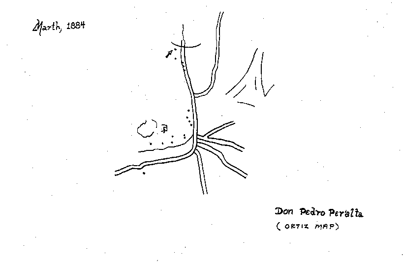
The Ortiz Map
July 7, 1998 © Thomas J. Kollenborn. All Rights Reserved.
There have been many maps associated with the Dutchman’s Lost Mine over the past century. None intrigue Dutch Hunters more than the Ortiz map.
There are several versions as to the origin of this particular map. The one version I have heard often is that told by Bob Corbin. When Corbin was Maricopa County Attorney he became very close friends with Arnold Ortiz, who happened to work at the Maricopa County Courthouse as a bailiff. Arnold was the son of Manuel Ortiz, and it was Manuel who possessed the Ortiz map.
According to Arnold, his father told the following story about how he came into possession of the map. Two Mexican prospectors had given the map to his father at their store, but never revealed the origin of the map. Arnold told Corbin he had only observed the map upside down and had never seen it any other way. His father would lay the map out on the kitchen table under a coal oil lamp and study it. Arnold would sit across the table from his father and often studied the upside down map. Manuel Ortiz searched for the mines noted on the map for several years with no real results. After Arnold grew up the map disappeared and Arnold never saw it again.
In the early 1990s the actual map on brown linen paper reappeared. A city councilperson from Payson found the map in her father’s possessions and let her friend Bob Corbin see it. She was curious as to if the map would lead Corbin to anything. Corbin took possession of the map and proceeded to check it out.
After a brief examination it was decided the map was authentic, or at least it was the map Arnold Ortiz had seen as a child. Corbin was allowed to make a copy of the Ortiz map for future reference and the original was returned to its owner.
A careful study of the map only confused the reader more. There was no starting point and everything on the map was generalized and difficult to identify other than Rio Salinas (Salt River). The map included a letter addressed to a Mr. Walsh, which many people have interpreted to be Jacob Waltz. The letter does guide you, in a roundabout way, to a site where a mine is supposed to be located. No gold mines have been rediscovered as a direct result of this map.
Another version as to the source of this map goes something like this. The origin of the map began in the Superstition Mountains near the confluence of Whiskey Springs Canyon and La Barge Canyon. Two Mexican prospectors ran into an Indian and he fired a couple of shots. The prospectors returned fire and killed the Indian. When the two prospectors searched the Indian, they found the map. The Mexicans took the map from the body of the Indian and rode west toward Mesa City. One of the Mexicans eventually gave the map to a Mr. Ortiz, Arnold Ortiz’s father.
The Ortiz map will become a part of Arizona history and legend when it comes to lost mines. Today, lost mine stories [dominate] the adventure column in Southwest writing. The Ortiz map is part of this American Southwest adventure.
Subscribe to:
Posts (Atom)