Tuesday, December 29, 1998

Tortilla Flat

December 29, 1998 © Thomas J. Kollenborn. All Rights Reserved. 

How Tortilla Flat was named is an enigma, and to this day it remains an enigma.

The Tortilla Flat road stop was founded in 1904 during the construction period of the great Roosevelt Dam and appears on most Arizona road maps. The location was ideal because of available water in Tortilla Creek, and soon after the establishment of the station a shallow well was also dug.

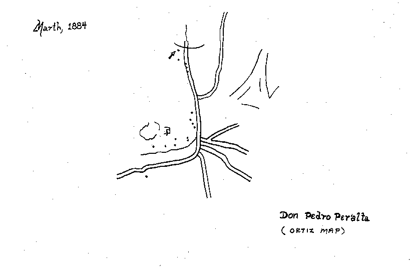
The purpose of the Tonto Road (Apache Trail), which proceeds up Tortilla Creek and then Mesquite Creek, was to get around the Box Canyon of the Salt River.

Settlers living in Tonto Basin after 1878 often used the river route to the Salt River Valley if it was a dry summer. There is good reason to believe the old timers camped on the flat across from present day Tortilla Flat, however that was long before the construction of any buildings, tents or roads.

The first tent houses were constructed in early 1904, for use by the road gangs working on the haul road between Mesa and the Roosevelt Dam site. A deeper well was later dug and the site continued to serve as a change station for teamsters who drove twenty-mule teams over the Mesa-Roosevelt Road.

The Apaches and Yavapais probably used this trail through the mountains to raid the Pimas along the Gila and Salt Rivers. The first Anglo-Americans to travel along this trail were probably mountain men who accompanied Paulino (Powell) Weaver when he trapped beaver and searched for gold alongthe Rio Salinas (Salt River) in 1827.

Anglo-Americans began to migrate into the area shortly after the signing of the Gadsden Purchase in 1854. This migration was reduced considerably during the American Civil War 1861-1865. After the war, it was American prospectors who found old Mexican workings north of the Pinal Mountains. These old workings eventually [led] to the discovery of the Old Dominion Mine in 1869. The Dominion produced a chunk of almost pure silver the size of a globe, and Globe, Arizona was named after this discovery. Globe eventually became the eastern terminus of the Apache Trail.

On March 10, 1875, the famous Silver King Mine was discovered just north of the present town of Superior. The development of the Silver King [led] to a need for fresh beef to feed to the miners, which soon resulted in a small thriving cattle industry. The demand brought more cattle drovers, sheepherders and farmers to Arizona Territory. Cattlemen and sheepherders lived in Tonto Basin and throughout the mountains of central Arizona. These early pioneers opened the Yavapai Trail from Tonto Basin to the Salt River Valley, a trail that would eventually become part of the Mesa-Roosevelt Road.

The Apache Trail, in a true sense, does not follow the exact path of the old Yavapai Trail, later called the Tonto Trail.

Earlier in this article I touched on the source of Tortilla Flat’s name. One version indicates the name originated with John Steinbeck’s novel Tortilla Flat. Actually, Steinbeck wrote a fictional novel about Spanish speaking people living in a barrio (Mexican ghetto) near Monterey, California in 1935. Tortilla Flat received its name long before Steinbeck wrote his novel, and it isn’t difficult to believe that Steinbeck borrowed Tortilla Flat’s name for his book.

[Part II]

Last week in Part One, I gave some of the history of the area around Tortilla Flat and touched on the source of its name. One version indicates the name originated with John Steinbeck’s novel “Tortilla Flat.” Actually, Steinbeck wrote a fictional novel about Spanish speaking people living in a barrio (Mexican ghetto) near Monterey, California in 1935. Tortilla Flat received its name long before Steinbeck wrote his novel, and it isn’t difficult to believe that Steinbeck borrowed Tortilla Flat’s name for his book.

Another popular version for the source of Tortilla Flat’s name involves a local landmark near the old Tortilla Ranch. There are some huge horizontally stratified rocks near the ranch that look like stacked Sonoran style tortillas. Cowboys working on the old Tortilla Ranch claimed the Spanish named one of these huge rocks Tortilla.

However, the following story may be the best source for Tortilla Flat’s name. This story is quoted in a letter to Mr. Ross Santee from the late Mr. Russell Perkins.

In earlier days when this was just a trail, some citizens of the Tonto Basin country had been to Phoenix for supplies. On their way back to Tonto they camped at the flat across the creek. That night it rained and they were water bound and had to stay there several days. In the meantime their food ran out except for some flour so they made tortillas. This was all they had to eat for several days and Mr. John Cline, one of the party, named this place Tortilla Flat. Mr. John Cline lived in Tonto Basin for over seventy-two years.

George Cline supported the claim that John Cline named Tortilla Flat and Mormon Flat. The Clines are some of the earliest settlers in the Tonto Basin region.

Tortilla Flat served as a stage and change station from 1904-1915. The Southern Pacific Railroad decided to promote the Mesa-Roosevelt Road as a tourist attraction in 1915. A Southern Pacific ticket agent changed the name of the road to Apache Trail because it sounded more Southwestern. Tourism was born along one of America’s most beautiful highways as a result of this change and promotion by the Southern Pacific. By 1917, the Southern Pacific Railroad offered the Apache Trail as a side trip on their Sunset Route. The railroad promoters used deep pockets to promote the Apache Trail across the United States with colorful brochures and thousands of dollars in periodical advertisements. This brought thousands of tourists to the Apache Trail and Tortilla Flat long before U.S. Highway 60 was completed in 1922. These tourists are the ones who have kept Tortilla Flat economically healthy over the decades. Horse-drawn Concord stages were used on the Apache Trail until about 1915 when they were replaced with motorized coaches. 

On March 19, 1911, Tortilla Flat had a visit from a [sitting] president of the United States. President Theodore Roosevelt passed through Tortilla Flat, riding in a Franklin Motor Car, on his way to dedicate Roosevelt Dam, which was named in his honor. Roosevelt later said the following of the Apache Trail:

The Apache Trail combines the grandeur of the Alps, the glory of the Rockies, the magnificence of the Grand Canyon and then adds an indefinable something that none of the others have. To me, it is most awe-inspiring and most sublimely beautiful.

The lodges, inns, and hotels along the Apache Trail between Government Well and Roosevelt Dam have been consumed by fire. These include Government Well, Jack’s Place, Tortilla Flat, Fish Creek Lodge, and the Apache Lodge at Roosevelt Lake. Tortilla Flat survived some forty-five years without a major fire, the longest of all the inns or hotels along the Apache Trail.

Tortilla Flat burned on April 21, 1987. It has since been rebuilt. Tortilla Flat has proven to be a tough little town that neither earthquake, flood or fire could destroy. This small community is a testimonial to the tenacity of its owners who believed so strongly in the American way of life.

Tuesday, December 15, 1998

Tuesday, December 1, 1998

Tuesday, November 10, 1998

Tuesday, November 3, 1998

Tuesday, October 27, 1998

Tuesday, October 20, 1998

The Spirit of a Cowboy

October 20, 1998 © Thomas J. Kollenborn. All Rights Reserved. 

Apache Junction News Note: Tom Kollenborn worked on the Barkley Cattle Ranch during its twilight years in the mid and late 1950s. Many interesting accounts occurred during these years. This is the first portion of a two-part story which reveals some of those special moments on horseback.

One early Spring morning I saddled up one of Barkley’s cow ponies preparing to check stock along the eastern perimeter of the ranch’s boundary. The day’s plan included a ride to the Horse Camp area at the head of Trap Canyon. My father had told me many interesting and intriguing stories about Trap Canyon and the prospectors who believed there was buried gold in the area. For this ride I [chose] Scooter, a strong bay horse standing sixteen hands high. He probably tipped the scales around eleven hundred pounds.

Riding to Upper Trap Canyon and Horse Camp Ridge would require a strong horse and chaps to protect my legs while busting through thorns and thick brush. In those days the only thing that cleared trails were cattle.

Barkley had told me to be on the lookout for young calves and mother cows, and reminded me that the old Brahma bull that frequented the area would probably be hanging around Horse Camp Springs. He warned me to use caution when in the old bull’s company. The old bull was easy to agitate and could be very dangerous.

Finally I pulled the cinch up tight, climbed into the saddle and started my long ride into the mountains. The clink of my mount’s metal shoes against the many rocks on the trail sort of mesmerized my thoughts as I watched the sun slowly rise over Coffee Flat Mountain. 

The ride up Miner’s Needle Canyon was steep and rough. The present trail was constructed in 1963, but in the 1950s there was no super highway like there is today. As I rode eastward through Miner’s Summit I could feel a cool gentle breeze blowing against my back. The beauty of early morning was spectacular.

I reined Scooter and followed the trail to the headwaters of Whiskey Springs Canyon. Scooter slowly picked his way down through the rocks into the bottom of the canyon. We soon passed the site of an old biplane that had rested on the canyon floor for more than twenty years. Barkley said two Canadian Army aviators from Falcon Field crashed there in 1942. “They were lucky to walk away,” I thought as I perused the old crash site.

The towering cliffs which form the eastern edge of La Barge Canyon overwhelm a horse and rider. We rode into the “box” of Upper La Barge Canyon and for the next forty-five minutes Scooter used all his energy to get us safely through. Crystal clear water trickled down the canyon on solid rock, occasionally forming a beautiful blue pool [of] water [where] the rock had been hollowed out by erosion. Once through the “box” I [breathed] a sigh of relief. Each ride through the “box” was a risk to life and limb, but risk came with the territory.

The upper reaches of La Barge Canyon were much greener. The vegetation was lush and the area didn’t look anything like the dry desert around the headquarters ranch on Padre Canyon. As I rode out of the “box” and past old man Bradford’s diggings, I thought of what a lonely and isolated life he must have lived here.

As I rode toward the headwaters of Trap Canyon, silence filled the air except for the occasional call of a Blue Jay or Raven. A covey of Gambel quail startled Scooter momentarily and at the same time five large Mule deer sprang from hiding and ran up a distant slope.

The sky was a deep dark blue accented by a burning ball of fire as the sun rose higher in the sky. I soon reached the low divide that separated the drainage of La Barge and Trap Canyon. I stopped for a few minutes and rested.

[Part II – October 20, 1998]

A small group of crossed Brahma-White Faced calves stood near a large Alligator juniper while the mother cows grazed nearby. As I rode across the basin which formed the headwaters of Trap Canyon, I found several more calves and their mothers. All the cattle I spotted looked in good shape. I circled the basin then rode up on Horse Camp Ridge. From this vantage point I could see the entire basin below me. I counted seventeen calves and some twenty cows. Three calves were missing or some of the cows were barren.

The ride to the basin had begun at first light, so I turned Scooter back toward La Barge Canyon and the trail home. The rays of light from the afternoon sun bounced off the yellow rock formations creating a color palette only an artist could appreciate. The canyon danced with a variety of colors ranging from red through brown to yellow caused by the brilliant rays of the sun. As I consumed [continued through?] the spectacular beauty of the area, my mind returned to tales of lost gold. The tales my father had told me about Mexican prospectors from along the Gila River who died here searching for lost gold.

He said they had a map that showed a cave shaped like a human head. As I rode down La Barge Canyon through the “box” I soon spotted the cave Dad had talked about. It was on the right side of the canyon about two-thirds of the way up from the bottom of the canyon. “Just another tale and an unusual landmark,” I thought.

As I turned Scooter up Whiskey Springs Canyon I [noticed] a large Red-Tailed hawk circling on the thermals in search of food. It wasn’t long before he swooped down and grabbed a ground squirrel and then settled on top of a giant Saguaro cactus to eat his catch.

It was late afternoon by the time I was back to Miner’s Summit. I sure didn’t want to ride Scooter down Miner’s Summit in the dark – daylight was bad enough. The big, strong bay worked his way down the canyon arriving safely at the bottom. Once at the bottom of the canyon it was a forty-five minute ride back to the ranch. As we rode briskly across the desert floor the sun was falling rapidly from the sky. I wanted to be in the home corral and have all the stock fed by dark. This was another typical day on the Barkley Ranch.

I tallied the cows and calves I had seen and reported their condition to Bill Barkley. He looked at me with a very sober eye and said, “Slim, half of those cows and calves you checked on belonged to Stone (another rancher). I hope he plans on paying for half your salary.”

I thought for a moment and replied, “Bill it was a beautiful ride. Oh, by the way, I did close the gate at the summit.”

I had ridden about twenty-two miles solo in some really rugged country and survived. Old Gus Barkley always said everything in these mountains either bites, stings, sticks or eats meat.

Once inside the ranch house and eating my supper I had to agree with old Gus, but the beauty and pure solitude of this cattle range would be something I would never forget. Hard work, long hours and little pay is not what keeps a cowboy on the range. It is the beauty of his surroundings, isolation and the stock he works with. This is the spirit of the cowboy.

That day’s work on the Quarter Circle U Ranch was more than forty years ago, yet it is still vivid in my mind. The Quarter Circle U Ranch (old Bark Ranch) is located in Pinal County near the southeastern end of Superstition Mountain.

Tuesday, October 6, 1998

Tuesday, September 29, 1998

Tuesday, September 22, 1998

The Reavis Valley

September 22, 1998 © Thomas J. Kollenborn. All Rights Reserved. 

The Reavis Valley has played a major role in the history of the Superstition Wilderness Area. This beautiful high mountain valley is located nineteen miles west of Apache Junction and twelve miles south of Apache Lake. The elevation of the valley ranges between four and five thousand feet above sea level, making it an ideal retreat from the torturous heat of the desert during the summer months.

The first settlers of the valley were probably the Hohokam or the Salado. They left no written record of their occupancy, but there are numerous ruins which are a mute testimony to their presence in this idyllic setting.

The first American settler in this valley was Elisha Marcus Reavis. He arrived sometime during 1874. It is believed by some historians that Reavis was a civilian packer for the army working out of Fort McDowell in the late 1860s. While packing for the army he was introduced to the isolation of the valley. The title “Hermit of Superstition Mountain” was bestowed on him by the early newspapers of the area because of his isolated existence in the valley. Reavis constructed a small dugout home on a valley flat above the stream bed. He then cleared the meadow and planted a garden. From this garden he supplied vegetables to the small mining communities which dotted the central mountain area of Arizona. The one thing which made this valley so inviting was the water. A spring-fed stream flows through the entire length of the valley which is filled with lush vegetation ranging from Ponderosa pines to giant sycamore trees.

The Department of Agriculture established the Tonto Preserve in 1909 to protect the watershed of the Salt River drainage basin. The goal of the U.S. Bureau of Reclamation was to [ensure] a future water supply for the development of agriculture in the Salt River Valley. The destruction of the Salt River’s drainage basin by urbanization would dramatically reduce the source of water for Roosevelt Dam and the Salt River lakes. The Superstition Wilderness Area is a part of this vital watershed.

Reavis operated a truck garden until the time of his death in 1896. His remains were found about four miles south of the Reavis Ranch near an old ruin on April 10, 1896. He was buried at the site of the ruins.

Soon after Reavis’ death, John Jack Fraser acquired the Reavis Valley for his cattle operation. Fraser sold his interest to W.J. Clemans in 1909, and with his two sons, Earl and Mark Twain, Clemans ran the ranch until 1946.

Upton and Bacon bought the ranch in 1946, then sold it to Floyd Stone and Kenneth Lockwood in 1956. Stone then sold it to the United States Department of Agriculture in 1966. The purchase of the Reavis Ranch ended the private ownership of land within the Superstition Wilderness Area.

Shortly after the turn of the century a group of Mesa entrepreneurs promoted the Reavis Ranch as a getaway from the hot summers in the valley. They proposed building a road to the Reavis Valley and selling lots. Their summer resort, which was to be called Pineair, never became a reality because of the remoteness and lack of access to the area. 

The Reavis Valley is about 2.1 miles long and about 0.4 miles wide at its widest point, amounting to about 220 acres of good pasture land. The Clemans family planted a large apple orchard and the Uptons also planted apples in the valley. The oldest apple trees in the valley are located south of the old ranch and the meadow south of the ranch produced a variety of grasses for grazing animals.

The Clemans had a weir on Reavis Creek and brought water down a canal system to a point just south of the ranch house. At this point there was a three to five acre pond with a depth of about 12 feet. Water was released from this pond to irrigate the orchard and fields below and to the north of the ranch. It was a full time job irrigating and maintaining the various fields. Reavis Creek is the only permanent stream in the Superstition Wilderness Area and most of the water in Reavis Creek originates from seepage and natural springs high in the mountain south of the ranch.

The ranch became a popular place for hikers after 1968. It remained a secret paradise for a few years, then, all of a sudden, hundreds of hikers and [horsemen] found the valley. Today in many areas the deadfall has all but vanished. Trash has become a problem also. There [are] just too many people in a small ecosystem. It will soon be destroyed if not managed in some way to prevent overuse.

The valley was so popular in the late 1980s that it wasn’t uncommon to find sixty to a hundred people camping in the area of the old ranch. On one extremely cold winter night, I spent a night in the house with forty-five campers. The temperature dropped well below freezing prior to sundown. I have actually met people on the trail in recent years who believed the old ranch house was still intact and were planning to stay in it because of bad weather.

The future of this delicate valley’s ecosystem lies in our hands. It is important how we care for it. Probably the most important thing we can do is carry out our trash, don’t contaminate the water and always be careful with fire.

Tuesday, September 8, 1998

Tuesday, September 1, 1998

Tuesday, August 25, 1998

Tuesday, August 18, 1998

The Secret of Haunted Canyon

August 18, 1998 © Thomas J. Kollenborn. All Rights Reserved. 

A Mesa Journal-Tribune article dated March 22, 1935 announced the discovery of a Kimberly strike in the Superstition Wilderness. “Kimberly” is a term used to describe a matrix of material that contains diamonds. The article read as follows:

A Kimberly in the Superstitions! Joe Modock, veteran prospector, came to Mesa this week with a sack of diamonds. The mine, he said, is situated in a secret canyon deep in the Superstitions, ‘where the geology is very different.’

He cautiously displayed a handful of rough sparklers, the largest of which was the size of a thumbnail. Modock stated that he has had a hunch for years that the Superstitions contained diamonds – not gold. He said he once prospected for diamonds in Africa.

Skeptics withheld serious comment in the absences of an assayer’s report. Modock said he was going to Phoenix for fresh supplies and promised even more startling disclosures as the mine develops.

He refused to disclose the location of the strike.

Joe Modock was not the first man to discover the “Cave of a Thousand Eyes” deep in the rugged Superstition Wilderness Area. Old Joe Modock really thought he had discovered diamonds when he made his way into an ancient limestone cavern in a small tributary off Haunted Canyon. What Modock actually found was a wall of travertine drapery filled with calcite crystals. He used his pick to chip off several small calcite (CaCO3) crystals and placed them into a sack.

It is not known whether Joe Modock knew his so-called diamonds were actually calcite crystals or if he was just ignorant about minerals. The Mesa Journal-Tribune claimed he was a veteran prospector.

Francisco “Frank” Moraga, a cattle rancher in the area c. 1890s, probably was one of the earliest visitors to this limestone cavern discovered by Modock. For many years the cave was known locally as Moraga Cave. It wasn’t until Jose Perez stumbled across the cave in July of 1916 that it received considerable publicity. Perez found the cave and subsequently called it the Lost Dutchman Mine. The large limestone cavern Perez found was filled with stalagmites and stalactites. Perez explored the cavern to a depth of 400 feet before giving up. He didn’t have sufficient light to safely explore the cave beyond that point. Once inside the first big chamber, one wall was covered with travertine drapery embedded with calcite crystals. It was from this drapery Modock chipped his crystals.

I visited the cave about fourteen years ago and you could still see the spot where old Joe Modock chipped out his calcite crystals. At this time the entrance to the cave was just about overgrown and covered with debris. I made an extensive effort to close the cave by piling broken pieces of limestone over the entrance. I returned a year later and almost couldn’t find the cave. This cave would be destroyed if the general public found it. I looked at caves in southern Arizona that have been destroyed by the collecting of limestone minerals.

Over the decades of time this large limestone cavern has had several names. According to Native American stories, the cave was known as the “Cave of a Thousand Eyes.” The source of this name is not difficult to visualize if you can imagine someone walking into the cave with a light or torch and seeing the calcite crystals on the travertine wall.

This cavern is just another one of those interesting mysteries which abound within the boundaries of the Superstition Wilderness [Area]. It is important that the location of this beautiful cavern remain secret for its own protection.

Tuesday, July 28, 1998

Tuesday, July 7, 1998

The Ortiz Map

July 7, 1998 © Thomas J. Kollenborn. All Rights Reserved. 

There have been many maps associated with the Dutchman’s Lost Mine over the past century. None intrigue Dutch Hunters more than the Ortiz map.

There are several versions as to the origin of this particular map. The one version I have heard often is that told by Bob Corbin. When Corbin was Maricopa County Attorney he became very close friends with Arnold Ortiz, who happened to work at the Maricopa County Courthouse as a bailiff. Arnold was the son of Manuel Ortiz, and it was Manuel who possessed the Ortiz map.

According to Arnold, his father told the following story about how he came into possession of the map. Two Mexican prospectors had given the map to his father at their store, but never revealed the origin of the map. Arnold told Corbin he had only observed the map upside down and had never seen it any other way. His father would lay the map out on the kitchen table under a coal oil lamp and study it. Arnold would sit across the table from his father and often studied the upside down map. Manuel Ortiz searched for the mines noted on the map for several years with no real results. After Arnold grew up the map disappeared and Arnold never saw it again.

In the early 1990s the actual map on brown linen paper reappeared. A city councilperson from Payson found the map in her father’s possessions and let her friend Bob Corbin see it. She was curious as to if the map would lead Corbin to anything. Corbin took possession of the map and proceeded to check it out.

After a brief examination it was decided the map was authentic, or at least it was the map Arnold Ortiz had seen as a child. Corbin was allowed to make a copy of the Ortiz map for future reference and the original was returned to its owner.

A careful study of the map only confused the reader more. There was no starting point and everything on the map was generalized and difficult to identify other than Rio Salinas (Salt River). The map included a letter addressed to a Mr. Walsh, which many people have interpreted to be Jacob Waltz. The letter does guide you, in a roundabout way, to a site where a mine is supposed to be located. No gold mines have been rediscovered as a direct result of this map.

Another version as to the source of this map goes something like this. The origin of the map began in the Superstition Mountains near the confluence of Whiskey Springs Canyon and La Barge Canyon. Two Mexican prospectors ran into an Indian and he fired a couple of shots. The prospectors returned fire and killed the Indian. When the two prospectors searched the Indian, they found the map. The Mexicans took the map from the body of the Indian and rode west toward Mesa City. One of the Mexicans eventually gave the map to a Mr. Ortiz, Arnold Ortiz’s father.

The Ortiz map will become a part of Arizona history and legend when it comes to lost mines. Today, lost mine stories [dominate] the adventure column in Southwest writing. The Ortiz map is part of this American Southwest adventure.

Tuesday, June 9, 1998

Goodbye, Mr. Arizona

June 9, 1998 © Thomas J. Kollenborn. All Rights Reserved. 

When I think of the Honorable Senator Barry M. Goldwater, I think of Arizona.

I grew up in Arizona with Barry Goldwater and I shared his love for this great state. His name was synonymous with the Grand Canyon, Monument Valley, Canyon de Chelly and the Salt River Valley. His vivid photographic images of Arizona and its people have always been a part of our lives. His zest of life was filled with adventures in Arizona so numerous I cannot list them; however, he still had time for the Superstition Mountains.

My father told me a story in 1949, about Barry Goldwater publishing a book for John T. Clymenson (pen name Barry Storm). The book was entitled “On the Trail of the Lost Dutchman.” Father had the book in his collection. He told how Clymenson showed his manuscript to Goldwater at his store in Phoenix and asked him to publish it. Goldwater looked the manuscript over and decided he would have it printed. He even joined Storm on a trip into the Superstition Mountains and took photographs for the book. According to Goldwater himself, he put up a few hundred dollars to publish the book and dedicated it to the Phoenix Don’s Club for the fine community service work they did.

Many years later, Barry Goldwater and I talked about the Lost Dutchman Mine and Superstition Mountain. He enjoyed talking about the mountains and the alleged gold mine. He told me about the time he went into the mountains with Barry Storm (John T. Clymenson) and took photographs. I was quite surprised he took time out of his busy schedule to talk to me about Barry Storm, the Superstition Mountains, and the Lost Dutchman Mine. Barry Goldwater loved Arizona history, even the legend and myth.

As George E. Johnston, President of the Superstition Mountain Museum, and I sat in Grady Gammage Auditorium attending Goldwater’s memorial service on Wednesday, June 3, 1998, I reflected on the few times during the past fifty-five years our trails had crossed. Actually, I spoke to the late senator only a couple times in all those years. The first time our trails crossed was at a parade down Central Avenue in Phoenix when he ran for the Senate, or had won his Senate seat, in 1952. I was a student at Phoenix Union High School. I remember some fellow students saying, “Barry from Goldwaters is running for, or was elected to, the Senate.”

I recall one time standing fifty or sixty feet from the late Senator at the rim of the Grand Canyon at Yavapai Point. I had several Boy Scouts with me that day. In less than ten minutes, they got a lesson on Arizona history they would never forget. 

The next time our trails crossed was in 1981. It was the year we asked Senator Goldwater if he would be willing to serve on the Honorary Board of Directors for the Superstition Mountain Historical Society. He promptly agreed to lend his name to the credibility of our organization.

I had the distinct honor of being involved with the Arizona Historical Foundation Lectures Series on Arizona at Kerr Cultural Center in Scottsdale one year. This was the same year Senator Goldwater was also a guest speaker. We visited about the Superstition Mountains and the many characters. We talked about Arizona Attorney General Bob Corbin and his interest in the Lost Dutchman Mine. I could sense in his voice his envy and love for adventure. He told me how as a young man he roamed the Superstitions.

Another time I recall our trails crossing was around Memorial Day 1989. Each Memorial Day since the erection of the Vietnam Memorial in Washington D.C. a friend or two and I would carry the Stars and Stripes up to the top of Superstition Mountain to fly in honor of the Vietnam veterans and all American veterans. It was never an easy task to accomplish on horseback. It was certainly a challenge, but worthwhile.

That particular Memorial Day, Len Clements of Channel 10 filmed us, the horses and the flag flying high on top of Superstition Mountain. He announced this gathering on top of Superstition Mountain as a salute to war veterans of America on the evening news. A few days later I received a message from Barry Goldwater expressing his admiration for our accomplishment. I knew that was something he would have done after hearing his comments.

Goldwater was enormously popular with Arizonans, but always accessible. Even if you didn’t agree with his politics you had to respect him for his honesty, tenacity and integrity. He always said what he thought even if it hurt his cause.

At his eulogy I believe Secretary of the Interior Bruce Babbit said it best, “Americans will always remember two Arizonans, one was Geronimo and the other was Barry Goldwater. They both loved Arizona and were willing to fight for it.”

The greatest tribute to this distinguished Senator from Arizona is that he will always be remembered throughout America as “Mr. Arizona.”

Tuesday, May 19, 1998

A Place Called Paradise

May 19, 1998 © Thomas J. Kollenborn. All Rights Reserved. 

Don’t we all sometimes dream of paradise and riches?

As a child I often dreamed of finding a lost gold mine or treasure, and accompanied my father on many excursions into the Superstition Mountains during the late 1940s. A friend of Father’s told us about a place called Paradise. As many of you probably already know, there is a place in Arizona called Paradise, but the Paradise my father and I looked for was in the heart of the Superstition Wilderness.

From a prospecting point of view, it wasn’t often that my father found the eastern end of the Superstition Wilderness interesting or even encouraging. But, Dad was told about a deep shaft with an iron door located in a canyon called Paradise near a spring of the same name in the eastern end of the Superstitions. Father believed nobody would dig a deep vertical shaft, let alone timber the shaft and put a head frame over it, unless there was good reason.

Our adventure started at the Reavis Ranch Road some twenty-eight miles down the Apache Trail from Apache Junction. We drove up to a site near Plow Saddle and parked Dad’s 1939 Ford four door. We picked up the old Plow Saddle trail and headed off into what Floyd Stone called the Frog Tank country just north of Cimeron Mountain.

We soon turned up Paradise Canyon and then up a small tributary. After a careful inspection of the area we found an old shaft, but it was not necessarily to our liking. The shaft was timbered with hand hewn lumber and was about thirty five feet deep. At the bottom of the shaft there were two tunnels running in opposite directions.

Father could not find any material on the surface that would encourage a prudent man to dig such a hole. He was convinced we had found another typical lost mine in the Superstition Wilderness, however there was no gold. It was just a good story. The old shaft probably dated to the turn of the century, or even earlier, and the work had been done by somebody who knew how to timber a vertical shaft. Father did find some bull quartz in the area, but it contained no sulfides or oxides other than silicon oxide, the primary ingredient of quartz.

As Dad and I looked around, we couldn’t imagine why anyone called this Paradise. It was rugged, brushy and very rocky terrain. Maybe the cattlemen called it Paradise because of the water that was available in the canyon for their cattle in the Spring of the year. Our two-day adventure to Paradise Canyon had been exciting and strenuous. We enjoyed our search for lost gold, but to me the real adventure was being out in the wilderness with my father, enjoying the beauty of God’s creation and just thinking about the old Dutchman and his lost gold mine.

The trail on down into Frog Springs did produce a few other interesting things. Near Frog Springs there were four or five old eight by eight timbers that may have been used for a head frame. They were drilled for one inch bolts and two inch stringers. Also, these timbers may have been intended for a corral that was never completed. And, of course, we could have just been over-speculating about their origin… in the late 1940s you could still get a four-wheel drive Jeep down into the canyon.

On our return trip to Plow Saddle we visited a large archaeological site on the right-hand side of the canyon. After exploring the area we hiked back out to Plow Saddle and called it a weekend.

The trip was a simple adventure I enjoyed with my father and I remember it to this day. No, we didn’t find any gold, but our treasure was being together and speculating about what happen[ed] here in Paradise fifty, or a hundred or thousand years ago.

Tuesday, April 28, 1998

The Secret of Bluff Springs

April 28, 1998 © Thomas J. Kollenborn. All Rights Reserved. 

Deep in the Superstition Wilderness Area is located an important source of water for the early cattlemen of the region. This site is known today as Bluff Springs.

According to old timers, this was one of the best permanent water sources in the region.

When I was first employed by the Barkley Cattle Company, I accompanied Bill Barkley to Bluff Springs. At that time Barkley had a tin line shack located a short distance east of the springs. The line shack was used to store feed and supplies, and the tin from which the cabin was constructed was hauled from Charlebois Spring by Jimmy Ruiz, according to Barkley.

During the late 1950s, I spent a considerable amount of time around the old cabin at Bluff Springs, using the cabin as a base camp when I worked on the corral and other water sources in the area. I rarely stayed in the line shack because it was usually infested with spiders, scorpions or snakes and sometimes a combination of all three.

The line shack had a water bucket and a dipper to drink out of. That bucket and Bluff Springs were a fine combination and amenity during the hot dry summers I often spent in and around that cabin.

Early one spring day, an old timer named Jack Riddle showed up at the Quarter Circle U Ranch. He was a friend of Gus Barkley, Bill’s father. We started talking about Sims Ely and Jim Bark, and he told me about a cave that was located on Bluff Springs Mountain that could have served as a Mexican or Spanish smelter.

The old man was so sincere I decided to look for the cave. He told me it was located on the side of the mountain just south of Hog Cave. I wasn’t even sure where Hog Cave was located. I had heard Barkley talk about Hog Cave, but I was too embarrassed to ask Riddle for the location.

I looked for what Riddle referred to as Hog Cave off and on for several weeks. I found a large cave south of Bluff Springs cabin that had a herd of javelinas living in it. I decided it was Hog Cave and made my search for the old smelter from that location. I knew Bill Barkley had a distinct displeasure for Dutch hunters and didn’t want them on his property. This wasn’t the case for old Gus Barkley, his father.

I might add at this point the cave actually did exist. The question as to whether or not it was a smelter remains unresolved to this day. Let me describe the cave and you make your own decision.

The cave is about twenty-five feet in depth. There was a hearth at the extreme rear of the cave, and the heart was designed so that air could be pumped into a bowl filled with charcoal. Immediately above the hearth was a vertical vent or flume which allowed for the exhaust of smoke. It could also function to allow the escape of vaporized gases from smelting.

Was the cave ever used for smelting? My guess is no. There was no sign of smelting in this cave other than the physical appearance of the hearth itself. Could this hearth be the real thing?

I built a fire in the hearth and all the smoke escaped up the flume or vent. A roaring fire created no smoke in the cave. Another interesting thing was the fire. As it burned, it created a draft through the cave. This would suggest the hearth functioned perfectly.

I was convinced at the time that I had found an old smelter of some kind until I was told that Native Americans who used caves like this could have pounded out the hearth for cooking and heating when they lived in the area. This theory is also a reasonable possibility.

The exact purpose of the cave’s stone hearth and flume remains a secret of the Bluff Springs area on the east side of Bluff Springs Mountain.

Tuesday, April 21, 1998

Wiggins' Gold

April 21, 1998 © Thomas J. Kollenborn. All Rights Reserved. 

The Tucson Citizen reported the discovery of the Dutchman’s Lost Mine on April 16, 1932, near Superior, Arizona. The first paragraph of the article read as follows:

A gold strike of wide proportions and averaging $12,000 to the ton was announced in Tucson today as having been found six miles from Superior in the Superstition Mountains. The reported discovery was made by Thomas Wiggins, 56, who showed handfuls of nuggets as big as marbles in the mining town today.

The Tucson Citizen’s report of the find caused a stampede to the site which was about six and a half miles from Superior near Picket Post Mountain. Wiggins, the discoverer of the mine, believed it to be the famous Lost Dutchman Mine.

Residents of the area rushed to the edge of the little gully to see the ledge of gold for themselves, and were turned back by armed guards. The ore was so rich that, when broken, it was still held together by ribbons of almost pure gold. At least that was the claim.

Armed guards were placed at the camp to keep high-graders away. Several shooting incidents did occur over the claims. All the land around the area in the Superstitions began to be filled upon by prospectors and miners as soon as the news was out about the gold discovery.

At the age of 19, Thomas W. Wiggins rode with Theodore Roosevelt and the Arizona Rough Riders during the Spanish-American War of 1898. Mr. Wiggins married a Miss Quarrels of Tucson in 1903. It was through his wife’s relation that he met an old Mexican man that told him about the Dutchman’s Lost Mine being located near a fortress-shaped mountain on the trail to Globe from Florence. Wiggins, after talking to several people, determined the mountain to be Picket Post.

Wiggins had lived in the Superior area for about five years before making the discovery. An old Phoenix man had told Wiggins that all men that had searched for gold in the Picket Post area in the early days usually found gold if they worked at it.

Wiggins said he followed this tip and eventually discovered this rich vein of gold and silver. Wiggins reported the ore assayed 124.5 ounces of gold per ton and ten ounces of silver to the ton. The principal vein was four to six inches thick. Other veins in the area ran from six dollars to fifty dollars per ton in gold and silver. Wiggins named his claims the Katie Claims, probably after his wife.

Thomas Wiggins eventually faded into obscurity along with his alleged claim of finding the Dutchman’s Lost Mine. Wiggins had found gold near Picket Post, but not in the quantity he first believed or reported. Even today gold can still be recovered in the area in minute amounts.

Maybe old Tom Wiggins’ true legacy was his walk up San Juan Hill in June of 1898 with Colonel Teddy Roosevelt and the Rough Riders. It’s going to be interesting to see how Wiggins will be remembered. Will he be remembered for the gold he found at Picket Post Mountain or the walk up San Juan Hill with Roosevelt in 1898?

Tuesday, March 31, 1998

A&E TV Explores the Superstitions

March 31, 1998 © Thomas J. Kollenborn. All Rights Reserved. 

The Arts and Entertainment Channel recently sent a Greystone Communications film crew into the Superstition Mountain Wilderness to explore the history and the beauty of the region.

The goal of the film producer, Rick Davis, was to present the history and spectacular beauty of the region. Davis found the history of the region extremely complex and with varied opinion. He and his staff made every effort to gather all the information about the area they could. They worked with the Arizona Historical Foundation, Salt River Project, Tonto National Forest, the Superstition Mountain Museum and many local residents. After several months of research filming began on Tuesday, January 6, 1998.

The first trip into the field was to a place called the Paint Mine, on a divide between Boulder and La Barge Canyon. The subject here was the old Paint Mine and the towering façade of Malapai Mountain. The next day was spent in Needle Canyon at Al Morrow’s old camp and near the site where Adolph Ruth’s skull was found on December 9, 1931. On the third day, the film crew traveled to Weaver’s Needle. It was in the shadows of Weaver’s Needle much of the contemporary history about the region was molded. The final day was spent on top of Black Top Mesa and in East Boulder Canyon. Black Top Mesa provided spectacular panoramic views of the Superstition Wilderness Area. All this was made possible by cooperation from the officials of the Tonto National Forest and the O.K. Corral Pack Outfitters.

Greystone Communication film crews returned to Apache Junction on Wednesday, January 21, 1998, to do a special segment with United States Senator John McCain at Lost Dutchman State Park. Senator McCain was the co-sponsor, with Congressman Udall, in setting aside fifty-five more sections of land for the Superstition Wilderness and the finalizing of the 1964 National Wilderness Act. McCain visited the Superstition Wilderness with members of the Superstition Mountain Historical Society in 1983, after the bill was passed in the U.S. Congress.

There are many positives and negatives about filming the history and beauty of this region. One positive includes visual access for the many mentally and physically handicapped who would otherwise never have an opportunity to experience the history and beauty we enjoy so much. Of course, the most common negative is, the documentary will bring more people to this wilderness and eventually ruin it for all of us.

The growth rate of the Salt River Valley is one of the highest in the nation. The reality is, controlled access will be the only way to manage this wilderness. Management controls may range from access fees, parking fees to permits in the future. 

Some day, the only access for the public may be through documentaries about the history and the beauty of this fragile desert wilderness. We are most fortunate that earlier planners preserved this 159,780 acre wilderness for future generations of Americans to enjoy. Future management will be a tremendous challenge for those in public office and those responsible for the management of this area. The lifestyle we moved to Apache Junction for is being rapidly consumed by high density development. The desert we know will be gone and the only reminder of it will be the lands preserved within the Tonto National Forest, such as the Superstition Wilderness Area.

A&E’s documentary on the History of the Superstition Mountain region aired Sunday, March 29, 1998 at 4:00 p.m. The producers of this film wanted to preserve the beauty, history and mystique of this wilderness. We have many friends who will enjoy this documentary but will never step a foot into the wilderness. I am sure they will appreciate this opportunity to view the history, legend and beauty of the Superstition Wilderness Area. After all, the history of this land is its people.

Tuesday, March 24, 1998

Searching For Gold

March 24, 1998 © Thomas J. Kollenborn. All Rights Reserved. 

The town of Goldfield, in the Arizona Territory, has undergone several changes during its one hundred and seven year[s] of existence.

The Mammoth Mine was discovered in April of 1893 and the town of Goldfield grew around it. According to some reports, more than a million dollars in gold was removed from the badly faulted formations in the area.

The ledge from which Charles Hall took over $1,000,000 in gold was the famous “Mormon Stope.” This bonanza pocket was lost in a fault and never rediscovered according to some mining experts. This led to the decline of Goldfield and eventually its abandonment. Mining men still believed the old mine had potential in the late 1920s. One man who believed in the potential of Goldfield and the Mammoth Mine was George U. Young, the last territorial secretary of Arizona and a prominent figure in political affairs.

Young spent a great deal of his money, as well as funds raised from the sale of stock in the east, to search for the ore body he believed lay below the desert. Young sunk the shaft deeper in his search for the lost gold ledge called Mormon Stope. He did not find the stope, but he did uncover ore that contained enough gold to make it profitable to process. During 1925, Young ran a small cyanide plant, but his equipment was old and crude, not efficient enough to extract the gold which would pay a profit to investors.

Young passed away suddenly on November 26, 1926 near Prescott, Arizona. His death [led] to the reorganization of the Young Mines Ltd. Under the new name Apache Trail Gold Ming Company. A.H. Sevringhaus served as the general manager.

Again, the operators struggled with financial problems in trying to reopen the mine. After several attempts to mine the Mammoth profitably, the Apache Trail Gold Mining Company also failed.

In early January of 1930 the mining company was completely reorganized again. The new organization was called the Metallurgical Research and Mining Company of Colorado. This new company leased the holdings of the Apache Trail Mining Company and hired their own superintendent to direct the development and operation of the Mammoth Mine. The man put in charge was Albert McCarthy.

Construction began immediately on a new mill which a company spokesman said would be producing bullion within ten days. A new amalgamator attached to the milling machinery was put in place. This refinement to the milling operation was expected to produce pure bullion on the property without the necessity of shipping the concentrates to a refinery. Also, ore would be hauled on a track from the old Black Queen shaft to the mill near the Apache Trail. Engineers believed there were vast quantities of gold ore beneath the surface in the Goldfield area. According to reports, there are several tons of gold ore on the dumps ready for processing in the new mill. 

Assays of quartz tested remarkably high in 1928, running from $90-$1,115 a ton. Most Arizona mining men of the period did not believe Goldfield was worked out. Even today men continue to work the gold veins of Goldfield hoping to strike it rich. Some claim if the old Dutchman of Lost Dutchman Mine fame had a mine it had to be located in Goldfield.

The Goldfield Mines have opened and shut down many times during the past one hundred and seven years. The production of gold bullion from the Goldfields more than a century ago has convinced a lot of prudent men that finding another bonanza is possible. So they continue to search, dig, dream and go broke. My father always said, “The Mammoth was one of those kind of mines that would make a poor man rich and a rich man poor.”

Tuesday, March 17, 1998

The Bark Ranch

March 17, 1998 © Thomas J. Kollenborn. All Rights Reserved. 

Located on the southeast end of Superstition Mountain is the historical Bark Ranch. This ranching endeavor dates back to 1877, and it was here, along Padre Canyon near a water seep, that Jack Minor squatted with a small drover’s herd. He planned to fatten his cattle then market them at the Silver King Mine.

Minor worked the squatter’s ranch for a short while then turned it over to Matt Cavanaugh. Cavanaugh constructed a fortress-type stone building with gun ports which still serves as a barn today. At the time this building was constructed the marauding Apache still roamed free in the area. The ranch was sold to George Marlow in 1885.

George Marlow was born in Montreal, Canada, along the St. Lawrence River in 1850. He had large cattle and sheep interests in Arizona. Marlow ran between three and four thousand head of cattle on his Superstition range when there was sufficient water and feed, and he certainly overgrazed these desert lands. Marlow owned and operated the ranch until his death on May 27, 1890. James Bark purchased the ranch in mid July of that year.

James A. Bark was born near New York City in 1860, and arrived in Arizona Territory in 1881. He was a printer who had turned to livestock raising and farming after settling in Arizona Territory. Bark was truly an interesting personality in early Arizona territorial days. He not only was interested in cattle raising, he was also an avid prospector constantly searching for an El Dorado. Bark’s lifelong prospecting partner was Sims Ely, general manager of the Salt River Water User’s Association. Together they searched the Superstition Mountains for the elusive Dutchman’s Lost Mine. Bark and Ely both made great contributions to the history of Arizona and to the legend and lore of this infamous lost mine story.

James Bark sold his ranch to William Augustus Barkley and a partner in 1907. The Bark Ranch soon became [known] as the Quarter Circle U Ranch because of Barkley’s brand. Gus and Gertrude Barkley operated the Quarter Circle U and the Quarter Circle W ranches from 1907-1955. The Quarter Circle W was also the 3Rs ranch.

Barkley passed away in October of 1955. Gertrude and her son, William Thomas Barkley, operated the ranch until 1963. Sometime after 1965 the ranch was sold to a conglomerate. Eventually Charles Backus acquired the ranch in 1977 and continues to operate it today. Like many other old ranches in Pinal County the Quarter Circle U Ranch is part [of] our heritage and legacy.

Tuesday, February 10, 1998

Tuesday, January 20, 1998

Weaver's Needle

January 20, 1998 © Thomas J. Kollenborn. All Rights Reserved. 

Southeast of First Water Trailhead lies a prominent landmark known throughout Lost Dutchman Mine lore. This landmark is Weaver’s Needle. This towering spire of rock rises to an elevation of 4,553 feet above sea level. Historians claim the “needle” was named after frontier scout, mountain man, prospector and trapper Paulino Weaver. The name, which appears on this landmark today, first appeared on maps around 1853. Weaver’s Needle has been known by other names such as Needle Rock, Statue Mountain and Picacho Peak.

Most maps which make reference to the Lost Dutchman Mine mention the “needle” in some way. This dominating feature is the focal point of the map. Many tales include words like “look for the pointed peak” or “the mine is located within a two mile radius of the needle rock.”

The geology of Weaver’s Needle appears to have confused many so-called geologist[s] over the years. Most of these individuals have referred to the “needle” as a volcanic plug. In reality this is not the case. Weaver’s Needle is an erosional remnant. There is adequate geological evidence to bear this out.

A volcanic plug is nothing more than the remains of a volcanic conduit. A conduit is that part of the volcano which transports the magma to the earth’s surface. When a volcano ceases to be active, the magma in the conduit solidifies, forming rock which is usually consistent and much more resistant to erosion than the material surrounding the conduit. A volcano plug is always quite consistent in the type of rock that is formed after the cessation of an eruption. This process is then followed by thousands or perhaps millions of years of erosion. The results of this erosional process leaves a volcanic plug exposed to the atmosphere.

There are two major characteristics which eliminate Weaver’s Needle from being a volcanic plug. One, the layers exposed near the base of the needle are alternating layers of ash and basalt, extrusive volcanics. Secondly, the faulting associated with the needle provides a clear-cut view of the alternating layers of basalt and ash. If Weaver’s Needle was indeed a volcanic plug, then there would be no alternating layers of ash and basalt. Ash is an eruptive pyroclastic which was ejected from a crater, vent, crack or cone during a volcanic eruption. If the needle was a plug there would be no indication of that layering. Most prospectors want to believe the needle is a volcanic plug because plugs are sometimes associated with rich mineralization.

During the 1950s such individuals as Edgar Piper, Maria Jones and many others made their home near the base of Weaver’s Needle. Their fascination for this rugged peak captured the imagination of the nation in documentaries and newspapers. These prospectors left quite a legacy behind.

Weaver’s Needle continues to fascinate men and women with its beauty and the towering spire of its façade. This landmark dominates the region east of Superstition Mountain. Those who have camped or slept in the shadows of the “needle” have been awed by the wilderness spirit.

Tuesday, January 13, 1998

The Paint Mine

January 13, 1998 © Thomas J. Kollenborn. All Rights Reserved. 

The Superstition Wilderness Area is filled with many interesting stories about people and places. One interesting story that comes to mind is the tale of the Paint Mine. The site of the old Paint Mine lies in Red Pass located between Boulder and La Barge Canyon, NE of Second Water. Today, only a few remnants remain to remind us of the men who once mined this area. The first prospectors probably visited this area before the turn of the century. The red rock in the area showed promise to many prospectors of the period.

Carl A. Silverlocke was working the Paint Mine in the summer of 1904. According to the Arizona Republican, a dead man was found in a tent belonging to Silverlocke at the Paint Mine. This was first reported on August 2, 1904 and again on August 5, 1904. Walter Hobson, who was working at the Mormon Flat road camp found the dead man on Thursday. Coroner F.T. Pomeroy held an inquest on the body at the Paint Mine on Saturday morning. Pomeroy and the coroner jury judged by the evidence at the site the man died of natural causes. There was no sign of foul play. The tent and camp the dead man was found in belonged to Carl A. Silverlocke.

Ten years later Silverlocke and his partner Malm would become well-known for their alleged discovery of gold ore near Superstition Mountain.

The dead man was later identified as Stephen MacKey, age 53, originally from New York. This was accomplished by the effort of Walter Hobson, a worker at the Mormon Flat road camp. MacKay had worked for the government road crew. He drew his pay and hiked into the mountains, ending up at the Paint Mine. He probably walked up either Boulder or La Barge Canyon.

The interesting thing about the newspaper article is that it established two important things. First it helps date the Paint Mine and also it identifies one of its early developers as Carl A. Silverlocke. Silverlocke had a cattle ranch in Wyoming prior to the turn of the century. He sold the ranch for $15,000 and came to Arizona in 1894. Silverlocke had a partner named Charles Goldleaf (actually Carl Malm). Malm was Silverlocke’s nephew. Both men were born in Sweden. Silverlocke’s first attempt to find gold was on the northwestern slope of Superstition Mountain. The Arizona Weekly Republican reported this attempt on July 4, 1901. The two men moved to the Paint Mine around 1903. Many old-timers considered Silverlocke and Goldleaf a pair who did not play with a full deck. On April 25, 1909, complaints of insanity were filed against both Silverlocke and Malm. Sheriff Jeff Adams took both men into custody on April 26, 1909.

A Mesa judge found Silverlocke insane and committed him to the state insane asylum. Malm was placed on the county poor farm. The periodicals of the era suggested “the search for gold led to this pair’s insanity.”

Over the next fifty years, after Silverlocke’s commitment to the insane asylum, several prospectors worked the old Paint Mine. Among them was Chuck Aylor in the mid 1950s and Ed McMann in the 1960s. Chuck and Peg Aylor built their dream home in La Barge Canyon near the site of the Paint Mine. The old Paint has been an attraction to hikers and horse[men] for forty years. The history of this site has been with us for more than eighty years and probably more like a hundred years or more.